Uster / Gschwader geodata
Uster / Gschwader (Zurich) is a section of populated place; located in Switzerland in Europe/Zurich (GMT+2) time zone. With population of 1,763 people, there are 918 cities with bigger population in this country. Compared to other cities in Switzerland, 65.8% of cities are located further ↓South; 75.4% of cities are located further ←West and 53.7% of cities have higher elevation than Uster / Gschwader. Note1


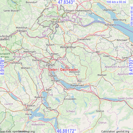
Uster / Gschwader GPS coordinates[2]
47° 21' 36.576" North, 8° 42' 50.04" East
| Map corner | latitude | longitude |
|---|---|---|
| Upper-left | 47.8343°, | 8.01078° |
| Center: | 47.36016°, | 8.7139° |
| Lower-right: | 46.88172°, | 9.41703° |
| Map W x H: | 105.9×105.9 km | = 65.8×65.8mi |
| max Lat: | 47.76737° ⇑34.2% North |
| Uster / Gschwader: | 47.36016° |
| min Lat: | ⇓65.8% South 45.83203° |
| min Long | Uster / Gschwad | max Long |
| 5.97153° | 8.7139° | 10.44624° |
| W 75.4%⇐ | ⇒24.6% E |
Elevation
Elevation of Uster / Gschwader is 470 m = 1542 ft, and this is 88.2 m = 289 ft below average elevation for this country.
| Max E: |
1845 m = 6053 ft | 53.7% |
| Avg. | 558.2 m = 1831 ft | |
| Uster / Gschwader | 470 m = 1542 ft | |
Min E: |
197 m = 646 ft | 46.3% |
See also: Switzerland elevation on elevation.city.
Geographical zone
Uster / Gschwader is located in North temperate zone (between Tropic of Cancer and the Arctic Circle). Distance of this North polar circle is 2135.2 km =1326.8 mi to North.| Distance of | km | miles | from Uster / Gschwader |
|---|---|---|---|
| North Pole | 4741.1 | 2946 | to North |
| Arctic Circle | 2135.2 | 1326.8 | to North |
| Tropic Cancer | 2660 | 1652.8 | to South |
| Equator | 5266 | 3272.1 | to South |


Nearby cities:
15 places around Uster / Gschwader: (largest is in red/bold)
• Greifensee
2.6 km =1.6 mi,  287°
287°
• Greifensee / Müllerwis / Seilerwis
2.7 km =1.7 mi,  295°
295°
• Greifensee / Ocht
3.1 km =1.9 mi, 298°
• Greifensee / Pfisterhölzli
1.9 km =1.2 mi,  284°
284°
• Gutenswil
2.7 km =1.7 mi,  6°
6°
• Nänikon
2.2 km =1.4 mi, 299°
• Nänikon / Nänikon (Dorfkern)
2 km =1.2 mi,  306°
306°
• Riedikon
3.2 km =2 mi,  181°
181°
• Uster
1.5 km =0.9 mi,  159°
159°
• Uster / Kirch-Uster
1.6 km =1 mi,  168°
168°
• Uster / Nieder-Uster
1.7 km =1.1 mi,  214°
214°
• Uster / Nossikon
2.3 km =1.4 mi, 157°
• Uster / Ober-Uster
1.9 km =1.2 mi,  131°
131°
• Volketswil / Volketswil (Dorf)
3.8 km =2.4 mi,  332°
332°
• Wermatswil
2.1 km =1.3 mi,  78°
78°
Sources, notices
• [Note1] Compared only with cities in Switzerland existing in our database
• [Src1] Map data: © OpenStreetMap contributors (CC-BY-SA)
• [Src2] Other city data from geonames.org with taken over terms of usage.
• [Src3] Geographical zone / Annual Mean Temperature by Robert A. Rohde @ Wikipedia
