Schottikon geodata
Schottikon (Zurich) is a populated place; located in Switzerland in Europe/Zurich (GMT+2) time zone. With population of 658 people, there are 1644 cities with bigger population in this country. Compared to other cities in Switzerland, 89% of cities are located further ↓South; 81.8% of cities are located further ←West and 54.7% of cities have lower elevation than Schottikon. Note1


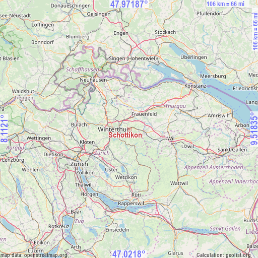
Schottikon GPS coordinates[2]
47° 29' 56.328" North, 8° 48' 54.792" East
| Map corner | latitude | longitude |
|---|---|---|
| Upper-left | 47.97187°, | 8.1121° |
| Center: | 47.49898°, | 8.81522° |
| Lower-right: | 47.0218°, | 9.51835° |
| Map W x H: | 105.6×105.6 km | = 65.6×65.6mi |
| max Lat: | 47.76737° ⇑11% North |
| Schottikon: | 47.49898° |
| min Lat: | ⇓89% South 45.83203° |
| min Long | Schottikon | max Long |
| 5.97153° | 8.81522° | 10.44624° |
| W 81.8%⇐ | ⇒18.2% E |
Elevation
Elevation of Schottikon is 494 m = 1621 ft, and this is 64.2 m = 211 ft below average elevation for this country.
| Max E: |
1845 m = 6053 ft | 45.3% |
| Avg. | 558.2 m = 1831 ft | |
| Schottikon | 494 m = 1621 ft | |
Min E: |
197 m = 646 ft | 54.7% |
See also: Switzerland elevation on elevation.city.
Geographical zone
Schottikon is located in North temperate zone (between Tropic of Cancer and the Arctic Circle). Distance of this North polar circle is 2119.8 km =1317.2 mi to North.| Distance of | km | miles | from Schottikon |
|---|---|---|---|
| North Pole | 4725.7 | 2936.4 | to North |
| Arctic Circle | 2119.8 | 1317.2 | to North |
| Tropic Cancer | 2675.5 | 1662.5 | to South |
| Equator | 5281.4 | 3281.7 | to South |


Nearby cities:
15 places around Schottikon: (largest is in red/bold)
• Elgg
3.8 km =2.4 mi,  93°
93°
• Elgg / Neu-Elgg
3.7 km =2.3 mi, 85°
• Elgg / Städtchen und Umgebung
3.9 km =2.4 mi,  100°
100°
• Elsau-Räterschen
1.3 km =0.8 mi,  286°
286°
• Elsau-Räterschen / Räterschen
1.4 km =0.9 mi,  271°
271°
• Oberwinterthur (Kreis 2)
4 km =2.5 mi,  299°
299°
• Oberwinterthur (Kreis 2) / Hegi
3.5 km =2.2 mi, 285°
• Oberwinterthur (Kreis 2) / Hegmatten
4.1 km =2.5 mi, 286°
• Rümikon
2.1 km =1.3 mi,  280°
280°
• Seen (Kreis 3)
4.2 km =2.6 mi,  233°
233°
• Seen (Kreis 3) / Büelwiesen
4.1 km =2.5 mi,  246°
246°
• Seen (Kreis 3) / Oberseen
3.7 km =2.3 mi,  239°
239°
• Seen (Kreis 3) / Sonnenberg
3.5 km =2.2 mi, 252°
• Wiesendangen / Steinegg
4.1 km =2.5 mi,  322°
322°
• Wiesendangen / Wiesendangen (Dorf)
3.2 km =2 mi, 322°
Sources, notices
• [Note1] Compared only with cities in Switzerland existing in our database
• [Src1] Map data: © OpenStreetMap contributors (CC-BY-SA)
• [Src2] Other city data from geonames.org with taken over terms of usage.
• [Src3] Geographical zone / Annual Mean Temperature by Robert A. Rohde @ Wikipedia
