Elgg geodata
Elgg (Zurich) is a populated place; located in Switzerland in Europe/Zurich (GMT+2) time zone. With population of 3,282 people, there are 536 cities with bigger population in this country. Compared to other cities in Switzerland, 88.7% of cities are located further ↓South; 83.8% of cities are located further ←West and 58% of cities have lower elevation than Elgg. Note1


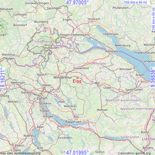
Elgg GPS coordinates[2]
47° 29' 49.74" North, 8° 51' 54.828" East
| Map corner | latitude | longitude |
|---|---|---|
| Upper-left | 47.97005°, | 8.16211° |
| Center: | 47.49715°, | 8.86523° |
| Lower-right: | 47.01995°, | 9.56836° |
| Map W x H: | 105.6×105.6 km | = 65.6×65.6mi |
| max Lat: | 47.76737° ⇑11.3% North |
| Elgg: | 47.49715° |
| min Lat: | ⇓88.7% South 45.83203° |
| min Long | Elgg | max Long |
| 5.97153° | 8.86523° | 10.44624° |
| W 83.8%⇐ | ⇒16.2% E |
Elevation
Elevation of Elgg is 508 m = 1667 ft, and this is 50.2 m = 165 ft below average elevation for this country.
| Max E: |
1845 m = 6053 ft | 42% |
| Avg. | 558.2 m = 1831 ft | |
| Elgg | 508 m = 1667 ft | |
Min E: |
197 m = 646 ft | 58% |
See also: Switzerland elevation on elevation.city.
Geographical zone
Elgg is located in North temperate zone (between Tropic of Cancer and the Arctic Circle). Distance of this North polar circle is 2120 km =1317.3 mi to North.| Distance of | km | miles | from Elgg |
|---|---|---|---|
| North Pole | 4725.9 | 2936.5 | to North |
| Arctic Circle | 2120 | 1317.3 | to North |
| Tropic Cancer | 2675.3 | 1662.4 | to South |
| Equator | 5281.2 | 3281.6 | to South |


Nearby cities:
15 places around Elgg: (largest is in red/bold)
• Aadorf
2.7 km =1.7 mi,  101°
101°
• Elgg / Neu-Elgg
0.5 km =0.3 mi,  346°
346°
• Elgg / Städtchen und Umgebung
0.5 km =0.3 mi,  166°
166°
• Elsau-Räterschen
5 km =3.1 mi,  276°
276°
• Elsau-Räterschen / Räterschen
5.2 km =3.2 mi,  272°
272°
• Gachnang
4.8 km =3 mi, 349°
• Hagenbuch
3.1 km =1.9 mi,  34°
34°
• Matzingen
5.7 km =3.5 mi,  64°
64°
• Rümikon
5.9 km =3.7 mi, 275°
• Schottikon
3.8 km =2.4 mi, 273°
• Seen (Kreis 3) / Oberseen
7.1 km =4.4 mi,  256°
256°
• Turbenthal
6.9 km =4.3 mi,  191°
191°
• Wiesendangen / Steinegg
7.1 km =4.4 mi,  298°
298°
• Wiesendangen / Wiesendangen (Dorf)
6.3 km =3.9 mi, 295°
• Wängi
6.6 km =4.1 mi,  90°
90°
Sources, notices
• [Note1] Compared only with cities in Switzerland existing in our database
• [Src1] Map data: © OpenStreetMap contributors (CC-BY-SA)
• [Src2] Other city data from geonames.org with taken over terms of usage.
• [Src3] Geographical zone / Annual Mean Temperature by Robert A. Rohde @ Wikipedia
