Wiesendangen / Wiesendangen (Dorf) geodata
Wiesendangen / Wiesendangen (Dorf) (Zurich) is a section of populated place; located in Switzerland in Europe/Zurich (GMT+2) time zone. With population of 1,649 people, there are 962 cities with bigger population in this country. Compared to other cities in Switzerland, 92.3% of cities are located further ↓South; 80.6% of cities are located further ←West and 53.7% of cities have higher elevation than Wiesendangen / Wiesendangen (Dorf). Note1
Current local time in Wiesendangen / Wiesendangen (Dorf):
08:58 AM, SaturdayDifference from your time zone: hours


Wiesendangen / Wiesendangen (Dorf) GPS coordinates[2]
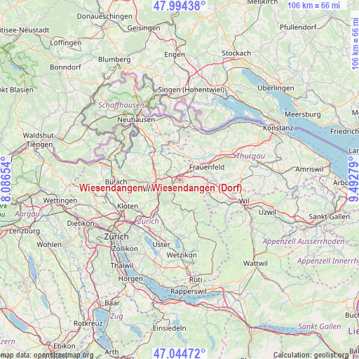
47° 31' 18.12" North, 8° 47' 22.812" East
| Map corner | latitude | longitude |
|---|---|---|
| Upper-left | 47.99438°, | 8.08654° |
| Center: | 47.5217°, | 8.78967° |
| Lower-right: | 47.04472°, | 9.49279° |
| Map W x H: | 105.6×105.6 km | = 65.6×65.6mi |
| max Lat: | 47.76737° ⇑7.7% North |
| Wiesendangen / Wiesendangen (Dorf): | 47.5217° |
| min Lat: | ⇓92.3% South 45.83203° |
| min Long | Wiesendangen / | max Long |
| 5.97153° | 8.78967° | 10.44624° |
| W 80.6%⇐ | ⇒19.4% E |
Elevation
Elevation of Wiesendangen / Wiesendangen (Dorf) is 470 m = 1542 ft, and this is 88.2 m = 289 ft below average elevation for this country.
| Max E: |
1845 m = 6053 ft | 53.7% |
| Avg. | 558.2 m = 1831 ft | |
| Wiesendangen / Wiesendangen (Dorf) | 470 m = 1542 ft | |
Min E: |
197 m = 646 ft | 46.3% |
See also: Switzerland elevation on elevation.city.
Geographical zone
Wiesendangen / Wiesendangen (Dorf) is located in North temperate zone (between Tropic of Cancer and the Arctic Circle). Distance of this North polar circle is 2117.3 km =1315.6 mi to North.| Distance of | km | miles | from Wiesendangen / Wiesendangen (Dorf) |
|---|---|---|---|
| North Pole | 4723.1 | 2934.8 | to North |
| Arctic Circle | 2117.3 | 1315.6 | to North |
| Tropic Cancer | 2678 | 1664 | to South |
| Equator | 5283.9 | 3283.3 | to South |


Nearby cities:
15 places around Wiesendangen / Wiesendangen (Dorf): (largest is in red/bold)
• Elsau-Räterschen
2.3 km =1.4 mi,  162°
162°
• Elsau-Räterschen / Räterschen
2.5 km =1.6 mi,  169°
169°
• Oberwinterthur (Kreis 2)
1.7 km =1.1 mi,  251°
251°
• Oberwinterthur (Kreis 2) / Grüze
3.6 km =2.2 mi,  223°
223°
• Oberwinterthur (Kreis 2) / Guggenbühl
2.4 km =1.5 mi, 247°
• Oberwinterthur (Kreis 2) / Hegi
2.2 km =1.4 mi, 221°
• Oberwinterthur (Kreis 2) / Hegmatten
2.4 km =1.5 mi,  236°
236°
• Oberwinterthur (Kreis 2) / Talacker
3.4 km =2.1 mi, 238°
• Oberwinterthur (Kreis 2) / Zinzikon
2.5 km =1.6 mi,  264°
264°
• Rickenbach
3.4 km =2.1 mi,  8°
8°
• Rümikon
2.2 km =1.4 mi,  184°
184°
• Schottikon
3.2 km =2 mi,  142°
142°
• Seen (Kreis 3) / Sonnenberg
3.9 km =2.4 mi,  202°
202°
• Sulz
2 km =1.2 mi,  358°
358°
• Wiesendangen / Steinegg
0.9 km =0.6 mi,  320°
320°
Sources, notices
• [Note1] Compared only with cities in Switzerland existing in our database
• [Src1] Map data: © OpenStreetMap contributors (CC-BY-SA)
• [Src2] Other city data from geonames.org with taken over terms of usage.
• [Src3] Geographical zone / Annual Mean Temperature by Robert A. Rohde @ Wikipedia
