Wiesendangen / Steinegg geodata
Wiesendangen / Steinegg (Zurich) is a section of populated place; located in Switzerland in Europe/Zurich (GMT+2) time zone. With population of 599 people, there are 1693 cities with bigger population in this country. Compared to other cities in Switzerland, 93.1% of cities are located further ↓South; 80.2% of cities are located further ←West and 52.6% of cities have lower elevation than Wiesendangen / Steinegg. Note1
Current local time in Wiesendangen / Steinegg:
07:39 AM, SaturdayDifference from your time zone: hours


Wiesendangen / Steinegg GPS coordinates[2]
47° 31' 40.62" North, 8° 46' 55.524" East
| Map corner | latitude | longitude |
|---|---|---|
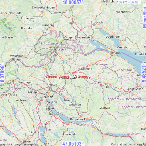
| Upper-left | 48.00057°, | 8.07896° |
| Center: | 47.52795°, | 8.78209° |
| Lower-right: | 47.05103°, | 9.48521° |
| Map W x H: | 105.6×105.6 km | = 65.6×65.6mi |
| max Lat: | 47.76737° ⇑6.9% North |
| Wiesendangen / Steinegg: | 47.52795° |
| min Lat: | ⇓93.1% South 45.83203° |
| min Long | Wiesendangen / | max Long |
| 5.97153° | 8.78209° | 10.44624° |
| W 80.2%⇐ | ⇒19.8% E |
Elevation
Elevation of Wiesendangen / Steinegg is 486 m = 1594 ft, and this is 72.2 m = 237 ft below average elevation for this country.
| Max E: |
1845 m = 6053 ft | 47.4% |
| Avg. | 558.2 m = 1831 ft | |
| Wiesendangen / Steinegg | 486 m = 1594 ft | |
Min E: |
197 m = 646 ft | 52.6% |
See also: Switzerland elevation on elevation.city.
Geographical zone
Wiesendangen / Steinegg is located in North temperate zone (between Tropic of Cancer and the Arctic Circle). Distance of this North polar circle is 2116.6 km =1315.2 mi to North.| Distance of | km | miles | from Wiesendangen / Steinegg |
|---|---|---|---|
| North Pole | 4722.4 | 2934.4 | to North |
| Arctic Circle | 2116.6 | 1315.2 | to North |
| Tropic Cancer | 2678.7 | 1664.5 | to South |
| Equator | 5284.6 | 3283.7 | to South |


Nearby cities:
15 places around Wiesendangen / Steinegg: (largest is in red/bold)
• Dinhard
3.2 km =2 mi,  339°
339°
• Elsau-Räterschen
3.1 km =1.9 mi,  156°
156°
• Elsau-Räterschen / Räterschen
3.4 km =2.1 mi, 161°
• Oberwinterthur (Kreis 2)
1.6 km =1 mi,  219°
219°
• Oberwinterthur (Kreis 2) / Guggenbühl
2.3 km =1.4 mi,  225°
225°
• Oberwinterthur (Kreis 2) / Hegi
2.5 km =1.6 mi,  200°
200°
• Oberwinterthur (Kreis 2) / Hegmatten
2.5 km =1.6 mi, 215°
• Oberwinterthur (Kreis 2) / Talacker
3.4 km =2.1 mi, 223°
• Oberwinterthur (Kreis 2) / Zinzikon
2.1 km =1.3 mi,  244°
244°
• Rickenbach
2.9 km =1.8 mi,  22°
22°
• Rümikon
2.9 km =1.8 mi,  172°
172°
• Seuzach / Seuzach (Dorf)
3.5 km =2.2 mi,  283°
283°
• Seuzach Dorf / Brandbüel
3.2 km =2 mi,  287°
287°
• Sulz
1.4 km =0.9 mi, 21°
• Wiesendangen / Wiesendangen (Dorf)
0.9 km =0.6 mi,  140°
140°
Sources, notices
• [Note1] Compared only with cities in Switzerland existing in our database
• [Src1] Map data: © OpenStreetMap contributors (CC-BY-SA)
• [Src2] Other city data from geonames.org with taken over terms of usage.
• [Src3] Geographical zone / Annual Mean Temperature by Robert A. Rohde @ Wikipedia
