Henggart geodata
Henggart (Zurich) is a populated place; located in Switzerland in Europe/Zurich (GMT+2) time zone. With population of 1,574 people, there are 991 cities with bigger population in this country. Compared to other cities in Switzerland, 95.7% of cities are located further ↓South; 72.8% of cities are located further ←West and 66.6% of cities have higher elevation than Henggart. Note1


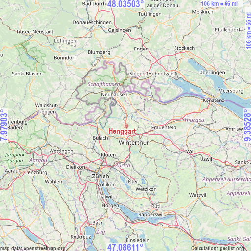
Henggart GPS coordinates[2]
47° 33' 45.792" North, 8° 40' 55.74" East
| Map corner | latitude | longitude |
|---|---|---|
| Upper-left | 48.03503°, | 7.97903° |
| Center: | 47.56272°, | 8.68215° |
| Lower-right: | 47.08611°, | 9.38528° |
| Map W x H: | 105.5×105.5 km | = 65.6×65.6mi |
| max Lat: | 47.76737° ⇑4.3% North |
| Henggart: | 47.56272° |
| min Lat: | ⇓95.7% South 45.83203° |
| min Long | Henggart | max Long |
| 5.97153° | 8.68215° | 10.44624° |
| W 72.8%⇐ | ⇒27.2% E |
Elevation
Elevation of Henggart is 443 m = 1453 ft, and this is 115.2 m = 378 ft below average elevation for this country.
| Max E: |
1845 m = 6053 ft | 66.6% |
| Avg. | 558.2 m = 1831 ft | |
| Henggart | 443 m = 1453 ft | |
Min E: |
197 m = 646 ft | 33.4% |
See also: Switzerland elevation on elevation.city.
Geographical zone
Henggart is located in North temperate zone (between Tropic of Cancer and the Arctic Circle). Distance of this North polar circle is 2112.7 km =1312.8 mi to North.| Distance of | km | miles | from Henggart |
|---|---|---|---|
| North Pole | 4718.6 | 2932 | to North |
| Arctic Circle | 2112.7 | 1312.8 | to North |
| Tropic Cancer | 2682.6 | 1666.9 | to South |
| Equator | 5288.5 | 3286.1 | to South |


Nearby cities:
15 places around Henggart: (largest is in red/bold)
• Andelfingen
3.5 km =2.2 mi,  355°
355°
• Dorf
2.8 km =1.7 mi,  293°
293°
• Hettlingen
2.5 km =1.6 mi,  136°
136°
• Hettlingen / Dorfkern
2.6 km =1.6 mi,  133°
133°
• Hettlingen / Gübel
3 km =1.9 mi,  123°
123°
• Kleinandelfingen
4.2 km =2.6 mi,  1°
1°
• Neftenbach / Dorf Neftenbach
4.1 km =2.5 mi,  198°
198°
• Ober-Ohringen
4.7 km =2.9 mi,  149°
149°
• Seuzach / Seuzach (Dorf)
5.1 km =3.2 mi, 126°
• Seuzach Dorf
4.8 km =3 mi, 128°
• Seuzach Dorf / Brandbüel
5.3 km =3.3 mi, 123°
• Seuzach Dorf / Breite-Weid
5.1 km =3.2 mi, 129°
• Seuzach Dorf / Hochgrüt-Scheidweg
5.1 km =3.2 mi, 134°
• Seuzach Dorf / Pünten-Ifang
4.5 km =2.8 mi, 128°
• Wülflingen (Kreis 6) / Härti
5.6 km =3.5 mi,  178°
178°
Sources, notices
• [Note1] Compared only with cities in Switzerland existing in our database
• [Src1] Map data: © OpenStreetMap contributors (CC-BY-SA)
• [Src2] Other city data from geonames.org with taken over terms of usage.
• [Src3] Geographical zone / Annual Mean Temperature by Robert A. Rohde @ Wikipedia
