Dietikon / Guggenbühl geodata
Dietikon / Guggenbühl (Zurich) is a section of populated place; located in Switzerland in Europe/Zurich (GMT+1) time zone. With population of 1,312 people, there are 1132 cities with bigger population in this country. Compared to other cities in Switzerland, 73.7% of cities are located further ↓South; 50.2% of cities are located further ←West and 91.1% of cities have higher elevation than Dietikon / Guggenbühl. Note1


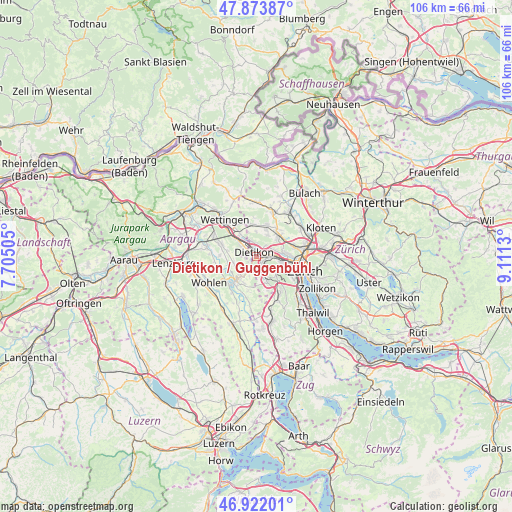
Dietikon / Guggenbühl GPS coordinates[2]
47° 24' 0.324" North, 8° 24' 29.448" East
| Map corner | latitude | longitude |
|---|---|---|
| Upper-left | 47.87387°, | 7.70505° |
| Center: | 47.40009°, | 8.40818° |
| Lower-right: | 46.92201°, | 9.1113° |
| Map W x H: | 105.8×105.8 km | = 65.7×65.7mi |
| max Lat: | 47.76737° ⇑26.3% North |
| Dietikon / Guggenbühl: | 47.40009° |
| min Lat: | ⇓73.7% South 45.83203° |
| min Long | Dietikon / Gugg | max Long |
| 5.97153° | 8.40818° | 10.44624° |
| W 50.2%⇐ | ⇒49.8% E |
Elevation
Elevation of Dietikon / Guggenbühl is 389 m = 1276 ft, and this is 169.2 m = 555 ft below average elevation for this country.
| Max E: |
1845 m = 6053 ft | 91.1% |
| Avg. | 558.2 m = 1831 ft | |
| Dietikon / Guggenbühl | 389 m = 1276 ft | |
Min E: |
197 m = 646 ft | 8.9% |
See also: Switzerland elevation on elevation.city.
Geographical zone
Dietikon / Guggenbühl is located in North temperate zone (between Tropic of Cancer and the Arctic Circle). Distance of this North polar circle is 2130.8 km =1324 mi to North.| Distance of | km | miles | from Dietikon / Guggenbühl |
|---|---|---|---|
| North Pole | 4736.7 | 2943.2 | to North |
| Arctic Circle | 2130.8 | 1324 | to North |
| Tropic Cancer | 2664.5 | 1655.6 | to South |
| Equator | 5270.4 | 3274.9 | to South |


Nearby cities:
15 places around Dietikon / Guggenbühl: (largest is in red/bold)
• Dietikon
0.6 km =0.4 mi,  286°
286°
• Dietikon / Almend
1.3 km =0.8 mi, 292°
• Dietikon / Hofacker
0.7 km =0.4 mi,  118°
118°
• Dietikon / Kreuzacker
0.5 km =0.3 mi,  258°
258°
• Dietikon / Oberdorf
1.1 km =0.7 mi,  273°
273°
• Dietikon / Rütematt
0.9 km =0.6 mi,  217°
217°
• Dietikon / Schönenwerd
1.4 km =0.9 mi,  104°
104°
• Dietikon / Unterdorf
0.7 km =0.4 mi,  349°
349°
• Dietikon / Vorstadt
1.2 km =0.7 mi,  317°
317°
• Fahrweid (nördl. Teil)
1.7 km =1.1 mi,  17°
17°
• Fahrweid (nördl. Teil) / Fahrweid
1.4 km =0.9 mi, 23°
• Fahrweid (südl. Teil)
1 km =0.6 mi, 24°
• Schlieren / Spital
1.8 km =1.1 mi,  109°
109°
• Urdorf / Bodenfeld
1.6 km =1 mi,  138°
138°
• Urdorf / Nieder-Urdorf
1.2 km =0.7 mi,  132°
132°
Sources, notices
• [Note1] Compared only with cities in Switzerland existing in our database
• [Src1] Map data: © OpenStreetMap contributors (CC-BY-SA)
• [Src2] Other city data from geonames.org with taken over terms of usage.
• [Src3] Geographical zone / Annual Mean Temperature by Robert A. Rohde @ Wikipedia
