Geroldswil / Bergacker geodata
Geroldswil / Bergacker (Zurich) is a section of populated place; located in Switzerland in Europe/Zurich (GMT+2) time zone. With population of 588 people, there are 1705 cities with bigger population in this country. Compared to other cities in Switzerland, 79% of cities are located further ↓South; 50.3% of cities are located further ←West and 59% of cities have higher elevation than Geroldswil / Bergacker. Note1
Current local time in Geroldswil / Bergacker:
07:43 AM, SaturdayDifference from your time zone: hours


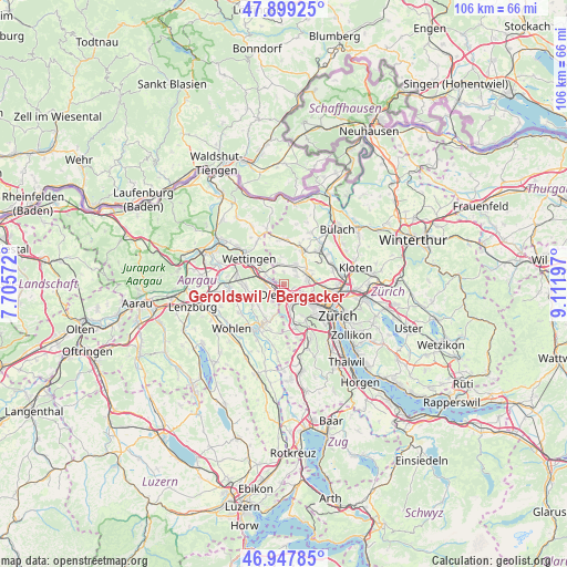
Geroldswil / Bergacker GPS coordinates[2]
47° 25' 32.52" North, 8° 24' 31.824" East
| Map corner | latitude | longitude |
|---|---|---|
| Upper-left | 47.89925°, | 7.70572° |
| Center: | 47.4257°, | 8.40884° |
| Lower-right: | 46.94785°, | 9.11197° |
| Map W x H: | 105.8×105.8 km | = 65.7×65.7mi |
| max Lat: | 47.76737° ⇑21% North |
| Geroldswil / Bergacker: | 47.4257° |
| min Lat: | ⇓79% South 45.83203° |
| min Long | Geroldswil / Be | max Long |
| 5.97153° | 8.40884° | 10.44624° |
| W 50.3%⇐ | ⇒49.7% E |
Elevation
Elevation of Geroldswil / Bergacker is 456 m = 1496 ft, and this is 102.2 m = 335 ft below average elevation for this country.
| Max E: |
1845 m = 6053 ft | 59% |
| Avg. | 558.2 m = 1831 ft | |
| Geroldswil / Bergacker | 456 m = 1496 ft | |
Min E: |
197 m = 646 ft | 41% |
See also: Switzerland elevation on elevation.city.
Geographical zone
Geroldswil / Bergacker is located in North temperate zone (between Tropic of Cancer and the Arctic Circle). Distance of this North polar circle is 2127.9 km =1322.2 mi to North.| Distance of | km | miles | from Geroldswil / Bergacker |
|---|---|---|---|
| North Pole | 4733.8 | 2941.4 | to North |
| Arctic Circle | 2127.9 | 1322.2 | to North |
| Tropic Cancer | 2667.3 | 1657.4 | to South |
| Equator | 5273.2 | 3276.6 | to South |


Nearby cities:
15 places around Geroldswil / Bergacker: (largest is in red/bold)
• Dietikon / Fondli
2.5 km =1.6 mi,  219°
219°
• Dietikon / Unterdorf
2.2 km =1.4 mi,  184°
184°
• Dietikon / Vorstadt
2.1 km =1.3 mi,  204°
204°
• Dällikon / Dällikon (Dorf)
2.7 km =1.7 mi,  54°
54°
• Dänikon
2.3 km =1.4 mi,  355°
355°
• Dänikon / Bifang
2.4 km =1.5 mi, 359°
• Fahrweid (nördl. Teil)
1.3 km =0.8 mi,  160°
160°
• Fahrweid (nördl. Teil) / Fahrweid
1.6 km =1 mi, 161°
• Fahrweid (südl. Teil)
2 km =1.2 mi,  169°
169°
• Geroldswil
0.4 km =0.2 mi, 159°
• Geroldswil / Haslern
0.8 km =0.5 mi,  136°
136°
• Geroldswil / Huebwiesen
0.4 km =0.2 mi, 172°
• Oetwil / Oetwil an der Limmat
1.1 km =0.7 mi,  285°
285°
• Rain
2 km =1.2 mi,  1°
1°
• Weiningen
2.2 km =1.4 mi,  106°
106°
Sources, notices
• [Note1] Compared only with cities in Switzerland existing in our database
• [Src1] Map data: © OpenStreetMap contributors (CC-BY-SA)
• [Src2] Other city data from geonames.org with taken over terms of usage.
• [Src3] Geographical zone / Annual Mean Temperature by Robert A. Rohde @ Wikipedia
