Urdorf / Baumgarten geodata
Urdorf / Baumgarten (Zurich) is a section of populated place; located in Switzerland in Europe/Zurich (GMT+2) time zone. With population of 902 people, there are 1411 cities with bigger population in this country. Compared to other cities in Switzerland, 68.9% of cities are located further ↓South; 50.9% of cities are located further ←West and 72.4% of cities have higher elevation than Urdorf / Baumgarten. Note1


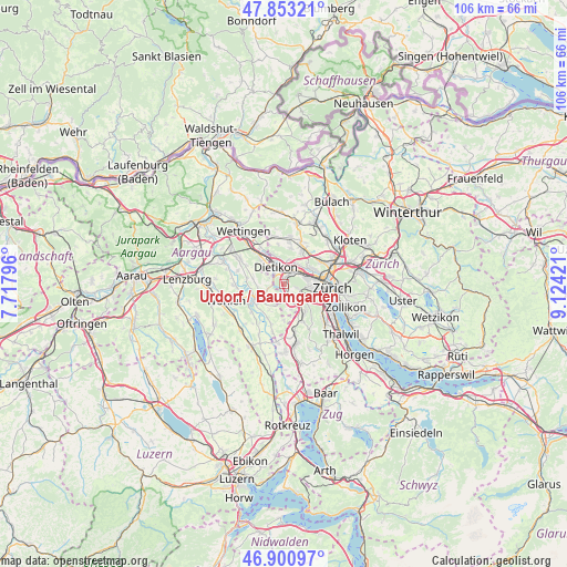
Urdorf / Baumgarten GPS coordinates[2]
47° 22' 45.264" North, 8° 25' 15.924" East
| Map corner | latitude | longitude |
|---|---|---|
| Upper-left | 47.85321°, | 7.71796° |
| Center: | 47.37924°, | 8.42109° |
| Lower-right: | 46.90097°, | 9.12421° |
| Map W x H: | 105.9×105.9 km | = 65.8×65.8mi |
| max Lat: | 47.76737° ⇑31.1% North |
| Urdorf / Baumgarten: | 47.37924° |
| min Lat: | ⇓68.9% South 45.83203° |
| min Long | Urdorf / Baumga | max Long |
| 5.97153° | 8.42109° | 10.44624° |
| W 50.9%⇐ | ⇒49.1% E |
Elevation
Elevation of Urdorf / Baumgarten is 436 m = 1430 ft, and this is 122.2 m = 401 ft below average elevation for this country.
| Max E: |
1845 m = 6053 ft | 72.4% |
| Avg. | 558.2 m = 1831 ft | |
| Urdorf / Baumgarten | 436 m = 1430 ft | |
Min E: |
197 m = 646 ft | 27.6% |
See also: Switzerland elevation on elevation.city.
Geographical zone
Urdorf / Baumgarten is located in North temperate zone (between Tropic of Cancer and the Arctic Circle). Distance of this North polar circle is 2133.1 km =1325.4 mi to North.| Distance of | km | miles | from Urdorf / Baumgarten |
|---|---|---|---|
| North Pole | 4739 | 2944.7 | to North |
| Arctic Circle | 2133.1 | 1325.4 | to North |
| Tropic Cancer | 2662.2 | 1654.2 | to South |
| Equator | 5268.1 | 3273.4 | to South |


Nearby cities:
15 places around Urdorf / Baumgarten: (largest is in red/bold)
• Dietikon / Hofacker
2 km =1.2 mi,  349°
349°
• Dietikon / Rütematt
2.2 km =1.4 mi,  316°
316°
• Dietikon / Schönenwerd
2 km =1.2 mi,  10°
10°
• Schlieren / Freiestrasse
2.4 km =1.5 mi,  40°
40°
• Schlieren / Pflugstrasse
2.2 km =1.4 mi,  30°
30°
• Schlieren / Spital
1.9 km =1.2 mi,  21°
21°
• Urdorf
0.7 km =0.4 mi, 28°
• Urdorf / Bodenfeld
1.1 km =0.7 mi, 6°
• Urdorf / Fadmatt
0.6 km =0.4 mi,  60°
60°
• Urdorf / Heidenkeller
0.8 km =0.5 mi, 37°
• Urdorf / Moos
1.3 km =0.8 mi, 26°
• Urdorf / Nieder-Urdorf
1.5 km =0.9 mi,  356°
356°
• Urdorf / Ob der Bahn
1.2 km =0.7 mi,  46°
46°
• Urdorf / Oberurdorf
0.2 km =0.1 mi, 46°
• Urdorf / Zentrum
0.8 km =0.5 mi, 15°
Sources, notices
• [Note1] Compared only with cities in Switzerland existing in our database
• [Src1] Map data: © OpenStreetMap contributors (CC-BY-SA)
• [Src2] Other city data from geonames.org with taken over terms of usage.
• [Src3] Geographical zone / Annual Mean Temperature by Robert A. Rohde @ Wikipedia
