Urdorf / Moos geodata
Urdorf / Moos (Zurich) is a section of populated place; located in Switzerland in Europe/Zurich (GMT+2) time zone. With population of 1,266 people, there are 1154 cities with bigger population in this country. Compared to other cities in Switzerland, 71.1% of cities are located further ↓South; 51.6% of cities are located further ←West and 77.8% of cities have higher elevation than Urdorf / Moos. Note1


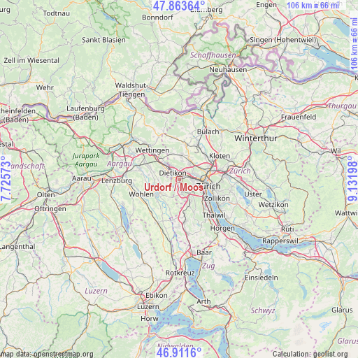
Urdorf / Moos GPS coordinates[2]
47° 23' 23.172" North, 8° 25' 43.896" East
| Map corner | latitude | longitude |
|---|---|---|
| Upper-left | 47.86364°, | 7.72573° |
| Center: | 47.38977°, | 8.42886° |
| Lower-right: | 46.9116°, | 9.13198° |
| Map W x H: | 105.9×105.9 km | = 65.8×65.8mi |
| max Lat: | 47.76737° ⇑28.9% North |
| Urdorf / Moos: | 47.38977° |
| min Lat: | ⇓71.1% South 45.83203° |
| min Long | Urdorf / Moos | max Long |
| 5.97153° | 8.42886° | 10.44624° |
| W 51.6%⇐ | ⇒48.4% E |
Elevation
Elevation of Urdorf / Moos is 426 m = 1398 ft, and this is 132.2 m = 434 ft below average elevation for this country.
| Max E: |
1845 m = 6053 ft | 77.8% |
| Avg. | 558.2 m = 1831 ft | |
| Urdorf / Moos | 426 m = 1398 ft | |
Min E: |
197 m = 646 ft | 22.2% |
See also: Switzerland elevation on elevation.city.
Geographical zone
Urdorf / Moos is located in North temperate zone (between Tropic of Cancer and the Arctic Circle). Distance of this North polar circle is 2131.9 km =1324.7 mi to North.| Distance of | km | miles | from Urdorf / Moos |
|---|---|---|---|
| North Pole | 4737.8 | 2943.9 | to North |
| Arctic Circle | 2131.9 | 1324.7 | to North |
| Tropic Cancer | 2663.3 | 1654.9 | to South |
| Equator | 5269.2 | 3274.1 | to South |


Nearby cities:
15 places around Urdorf / Moos: (largest is in red/bold)
• Dietikon / Hofacker
1.3 km =0.8 mi,  310°
310°
• Dietikon / Schönenwerd
0.8 km =0.5 mi,  343°
343°
• Schlieren / Freiestrasse
1.2 km =0.7 mi,  55°
55°
• Schlieren / Kamp
1.3 km =0.8 mi,  70°
70°
• Schlieren / Pflugstrasse
0.9 km =0.6 mi,  36°
36°
• Schlieren / Spital
0.6 km =0.4 mi,  10°
10°
• Urdorf
0.6 km =0.4 mi,  203°
203°
• Urdorf / Baumgarten
1.3 km =0.8 mi,  206°
206°
• Urdorf / Bodenfeld
0.5 km =0.3 mi,  262°
262°
• Urdorf / Fadmatt
0.9 km =0.6 mi,  182°
182°
• Urdorf / Heidenkeller
0.5 km =0.3 mi,  189°
189°
• Urdorf / Nieder-Urdorf
0.8 km =0.5 mi,  297°
297°
• Urdorf / Ob der Bahn
0.4 km =0.2 mi,  133°
133°
• Urdorf / Oberurdorf
1.1 km =0.7 mi, 202°
• Urdorf / Zentrum
0.6 km =0.4 mi,  220°
220°
Sources, notices
• [Note1] Compared only with cities in Switzerland existing in our database
• [Src1] Map data: © OpenStreetMap contributors (CC-BY-SA)
• [Src2] Other city data from geonames.org with taken over terms of usage.
• [Src3] Geographical zone / Annual Mean Temperature by Robert A. Rohde @ Wikipedia
