Sellenbüren geodata
Sellenbüren (Zurich) is a section of populated place; located in Switzerland in Europe/Zurich (GMT+2) time zone. With population of 1,572 people, there are 994 cities with bigger population in this country. Compared to other cities in Switzerland, 63.9% of cities are located further ↓South; 56% of cities are located further ←West and 67.8% of cities have lower elevation than Sellenbüren. Note1


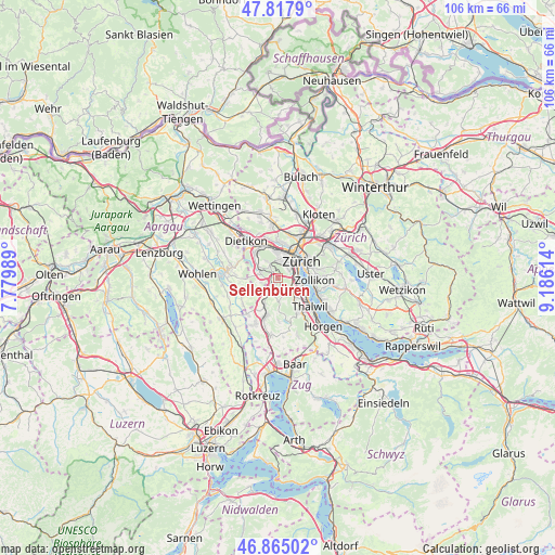
Sellenbüren GPS coordinates[2]
47° 20' 36.996" North, 8° 28' 58.836" East
| Map corner | latitude | longitude |
|---|---|---|
| Upper-left | 47.8179°, | 7.77989° |
| Center: | 47.34361°, | 8.48301° |
| Lower-right: | 46.86502°, | 9.18614° |
| Map W x H: | 106×105.9 km | = 65.9×65.8mi |
| max Lat: | 47.76737° ⇑36.1% North |
| Sellenbüren: | 47.34361° |
| min Lat: | ⇓63.9% South 45.83203° |
| min Long | Sellenbüren | max Long |
| 5.97153° | 8.48301° | 10.44624° |
| W 56%⇐ | ⇒44% E |
Elevation
Elevation of Sellenbüren is 561 m = 1841 ft, and this is 2.8 m = 9 ft above average elevation for this country.
| Max E: |
1845 m = 6053 ft | 32.2% |
| Sellenbüren | 561 m 1841 ft | |
| Avg. | 558.2 m = 1831 ft | |
Min E: |
197 m = 646 ft | 67.8% |
See also: Switzerland elevation on elevation.city.
Geographical zone
Sellenbüren is located in North temperate zone (between Tropic of Cancer and the Arctic Circle). Distance of this North polar circle is 2137.1 km =1327.9 mi to North.| Distance of | km | miles | from Sellenbüren |
|---|---|---|---|
| North Pole | 4742.9 | 2947.1 | to North |
| Arctic Circle | 2137.1 | 1327.9 | to North |
| Tropic Cancer | 2658.2 | 1651.7 | to South |
| Equator | 5264.1 | 3271 | to South |


Nearby cities:
15 places around Sellenbüren: (largest is in red/bold)
• Aesch
3.3 km =2.1 mi,  256°
256°
• Birmensdorf
3.3 km =2.1 mi,  292°
292°
• Birmensdorf / Haslen
2.5 km =1.6 mi,  317°
317°
• Schachen
2.3 km =1.4 mi,  200°
200°
• Uitikon / Waldegg
2.6 km =1.6 mi,  327°
327°
• Wettswil
0.9 km =0.6 mi,  219°
219°
• Wettswil / Ausser-Dorf
1.4 km =0.9 mi, 198°
• Wettswil / Wettswil (Dorf)
0.9 km =0.6 mi, 255°
• Zürich (Kreis 2)
2.9 km =1.8 mi,  103°
103°
• Zürich (Kreis 2) / Mittel-Leimbach
3.1 km =1.9 mi,  131°
131°
• Zürich (Kreis 2) / Unter-Leimbach
2.6 km =1.6 mi,  115°
115°
• Zürich (Kreis 3)
2.2 km =1.4 mi,  43°
43°
• Zürich (Kreis 3) / Alt-Wiedikon
3.2 km =2 mi,  49°
49°
• Zürich (Kreis 3) / Friesenberg
2.7 km =1.7 mi, 35°
• Zürich (Kreis 9) / Albisrieden
3.4 km =2.1 mi,  8°
8°
Sources, notices
• [Note1] Compared only with cities in Switzerland existing in our database
• [Src1] Map data: © OpenStreetMap contributors (CC-BY-SA)
• [Src2] Other city data from geonames.org with taken over terms of usage.
• [Src3] Geographical zone / Annual Mean Temperature by Robert A. Rohde @ Wikipedia
