Zürich (Kreis 6) / Unterstrass geodata
Zürich (Kreis 6) / Unterstrass (Zurich) is a section of populated place; located in Switzerland in Europe/Zurich (GMT+2) time zone. With population of 20,045 people, there are 41 cities with bigger population in this country. Compared to other cities in Switzerland, 72.7% of cities are located further ↓South; 60.5% of cities are located further ←West and 50.9% of cities have higher elevation than Zürich (Kreis 6) / Unterstrass. Note1
Current local time in Zürich (Kreis 6) / Unterstrass:
08:58 AM, SaturdayDifference from your time zone: hours


Zürich (Kreis 6) / Unterstrass GPS coordinates[2]
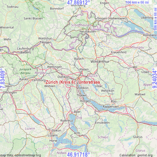
47° 23' 43.08" North, 8° 32' 13.956" East
| Map corner | latitude | longitude |
|---|---|---|
| Upper-left | 47.86912°, | 7.83409° |
| Center: | 47.3953°, | 8.53721° |
| Lower-right: | 46.91718°, | 9.24034° |
| Map W x H: | 105.8×105.8 km | = 65.7×65.7mi |
| max Lat: | 47.76737° ⇑27.3% North |
| Zürich (Kreis 6) / Unterstrass: | 47.3953° |
| min Lat: | ⇓72.7% South 45.83203° |
| min Long | Zürich (Kreis | max Long |
| 5.97153° | 8.53721° | 10.44624° |
| W 60.5%⇐ | ⇒39.5% E |
Elevation
Elevation of Zürich (Kreis 6) / Unterstrass is 476 m = 1562 ft, and this is 82.2 m = 270 ft below average elevation for this country.
| Max E: |
1845 m = 6053 ft | 50.9% |
| Avg. | 558.2 m = 1831 ft | |
| Zürich (Kreis 6) / Unterstrass | 476 m = 1562 ft | |
Min E: |
197 m = 646 ft | 49.1% |
See also: Switzerland elevation on elevation.city.
Geographical zone
Zürich (Kreis 6) / Unterstrass is located in North temperate zone (between Tropic of Cancer and the Arctic Circle). Distance of this North polar circle is 2131.3 km =1324.3 mi to North.| Distance of | km | miles | from Zürich (Kreis 6) / Unterstrass |
|---|---|---|---|
| North Pole | 4737.2 | 2943.6 | to North |
| Arctic Circle | 2131.3 | 1324.3 | to North |
| Tropic Cancer | 2663.9 | 1655.3 | to South |
| Equator | 5269.9 | 3274.6 | to South |


Nearby cities:
15 places around Zürich (Kreis 6) / Unterstrass: (largest is in red/bold)
• Zürich (Kreis 1) / City
2.5 km =1.6 mi,  182°
182°
• Zürich (Kreis 1) / Lindenhof
2.6 km =1.6 mi,  174°
174°
• Zürich (Kreis 1) / Rathaus
2.7 km =1.7 mi, 167°
• Zürich (Kreis 10) / Wipkingen
0.9 km =0.6 mi,  268°
268°
• Zürich (Kreis 11) / Oerlikon
1.5 km =0.9 mi,  15°
15°
• Zürich (Kreis 12) / Saatlen
2.7 km =1.7 mi,  49°
49°
• Zürich (Kreis 4) / Aussersihl
2.3 km =1.4 mi,  211°
211°
• Zürich (Kreis 4) / Hard
2.5 km =1.6 mi,  237°
237°
• Zürich (Kreis 4) / Langstrasse
2.1 km =1.3 mi,  198°
198°
• Zürich (Kreis 5)
1.5 km =0.9 mi,  234°
234°
• Zürich (Kreis 5) / Escher-Wyss
1.9 km =1.2 mi,  253°
253°
• Zürich (Kreis 5) / Gewerbeschule
1.3 km =0.8 mi, 204°
• Zürich (Kreis 6)
0.6 km =0.4 mi,  124°
124°
• Zürich (Kreis 6) / Oberstrass
1.2 km =0.7 mi, 124°
• Zürich (Kreis 7) / Fluntern
2.5 km =1.6 mi,  132°
132°
Sources, notices
• [Note1] Compared only with cities in Switzerland existing in our database
• [Src1] Map data: © OpenStreetMap contributors (CC-BY-SA)
• [Src2] Other city data from geonames.org with taken over terms of usage.
• [Src3] Geographical zone / Annual Mean Temperature by Robert A. Rohde @ Wikipedia
