Uitikon / Halde geodata
Uitikon / Halde (Zurich) is a section of populated place; located in Switzerland in Europe/Zurich (GMT+2) time zone. With population of 633 people, there are 1661 cities with bigger population in this country. Compared to other cities in Switzerland, 68.3% of cities are located further ↓South; 53.5% of cities are located further ←West and 71.9% of cities have lower elevation than Uitikon / Halde. Note1


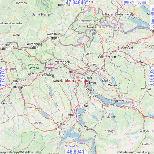
Uitikon / Halde GPS coordinates[2]
47° 22' 20.748" North, 8° 27' 21.24" East
| Map corner | latitude | longitude |
|---|---|---|
| Upper-left | 47.84646°, | 7.75278° |
| Center: | 47.37243°, | 8.4559° |
| Lower-right: | 46.8941°, | 9.15903° |
| Map W x H: | 105.9×105.9 km | = 65.8×65.8mi |
| max Lat: | 47.76737° ⇑31.7% North |
| Uitikon / Halde: | 47.37243° |
| min Lat: | ⇓68.3% South 45.83203° |
| min Long | Uitikon / Halde | max Long |
| 5.97153° | 8.4559° | 10.44624° |
| W 53.5%⇐ | ⇒46.5% E |
Elevation
Elevation of Uitikon / Halde is 586 m = 1923 ft, and this is 27.8 m = 91 ft above average elevation for this country.
| Max E: |
1845 m = 6053 ft | 28.1% |
| Uitikon / Halde | 586 m 1923 ft | |
| Avg. | 558.2 m = 1831 ft | |
Min E: |
197 m = 646 ft | 71.9% |
See also: Switzerland elevation on elevation.city.
Geographical zone
Uitikon / Halde is located in North temperate zone (between Tropic of Cancer and the Arctic Circle). Distance of this North polar circle is 2133.9 km =1325.9 mi to North.| Distance of | km | miles | from Uitikon / Halde |
|---|---|---|---|
| North Pole | 4739.7 | 2945.1 | to North |
| Arctic Circle | 2133.9 | 1325.9 | to North |
| Tropic Cancer | 2661.4 | 1653.7 | to South |
| Equator | 5267.3 | 3272.9 | to South |


Nearby cities:
15 places around Uitikon / Halde: (largest is in red/bold)
• Birmensdorf
2.2 km =1.4 mi,  207°
207°
• Birmensdorf / Haslen
1.4 km =0.9 mi,  165°
165°
• Schlieren / Halde
2.6 km =1.6 mi,  8°
8°
• Schlieren / Kamp
2.5 km =1.6 mi,  339°
339°
• Uitikon
0.4 km =0.2 mi, 167°
• Uitikon / Uitikon (Dorfkern)
0.3 km =0.2 mi,  225°
225°
• Uitikon / Waldegg
1.2 km =0.7 mi,  147°
147°
• Urdorf
2.7 km =1.7 mi,  301°
301°
• Urdorf / Baumgarten
2.7 km =1.7 mi,  286°
286°
• Urdorf / Fadmatt
2.3 km =1.4 mi, 297°
• Urdorf / Heidenkeller
2.5 km =1.6 mi, 303°
• Urdorf / Ob der Bahn
2.4 km =1.5 mi,  313°
313°
• Urdorf / Oberurdorf
2.6 km =1.6 mi, 290°
• Zürich (Kreis 9)
2.1 km =1.3 mi,  58°
58°
• Zürich (Kreis 9) / Albisrieden
2.6 km =1.6 mi,  86°
86°
Sources, notices
• [Note1] Compared only with cities in Switzerland existing in our database
• [Src1] Map data: © OpenStreetMap contributors (CC-BY-SA)
• [Src2] Other city data from geonames.org with taken over terms of usage.
• [Src3] Geographical zone / Annual Mean Temperature by Robert A. Rohde @ Wikipedia
