Rifferswil geodata
Rifferswil (Zurich) is a populated place; located in Switzerland in Europe/Zurich (GMT+2) time zone. With population of 604 people, there are 1687 cities with bigger population in this country. Compared to other cities in Switzerland, 51.2% of cities are located further ↓South; 56.5% of cities are located further ←West and 71.8% of cities have lower elevation than Rifferswil. Note1


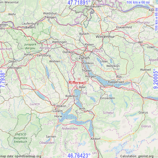
Rifferswil GPS coordinates[2]
47° 14' 37.392" North, 8° 29' 48.912" East
| Map corner | latitude | longitude |
|---|---|---|
| Upper-left | 47.71891°, | 7.7938° |
| Center: | 47.24372°, | 8.49692° |
| Lower-right: | 46.76423°, | 9.20005° |
| Map W x H: | 106.2×106.1 km | = 66×65.9mi |
| max Lat: | 47.76737° ⇑48.8% North |
| Rifferswil: | 47.24372° |
| min Lat: | ⇓51.2% South 45.83203° |
| min Long | Rifferswil | max Long |
| 5.97153° | 8.49692° | 10.44624° |
| W 56.5%⇐ | ⇒43.5% E |
Elevation
Elevation of Rifferswil is 585 m = 1919 ft, and this is 26.8 m = 88 ft above average elevation for this country.
| Max E: |
1845 m = 6053 ft | 28.2% |
| Rifferswil | 585 m 1919 ft | |
| Avg. | 558.2 m = 1831 ft | |
Min E: |
197 m = 646 ft | 71.8% |
See also: Switzerland elevation on elevation.city.
Geographical zone
Rifferswil is located in North temperate zone (between Tropic of Cancer and the Arctic Circle). Distance of this North polar circle is 2148.2 km =1334.8 mi to North.| Distance of | km | miles | from Rifferswil |
|---|---|---|---|
| North Pole | 4754.1 | 2954.1 | to North |
| Arctic Circle | 2148.2 | 1334.8 | to North |
| Tropic Cancer | 2647.1 | 1644.8 | to South |
| Equator | 5253 | 3264.1 | to South |


Nearby cities:
15 places around Rifferswil: (largest is in red/bold)
• Aeugst / Aeugst (Dorf)
3 km =1.9 mi,  342°
342°
• Aeugst am Albis
2.7 km =1.7 mi, 341°
• Affoltern / Butzen
4.7 km =2.9 mi,  320°
320°
• Affoltern / Goldiger Berg
5.5 km =3.4 mi,  314°
314°
• Affoltern / Hasenbüel
4.7 km =2.9 mi, 314°
• Affoltern / Oberdorf
4.9 km =3 mi, 321°
• Affoltern / Sonnenberg
4.9 km =3 mi,  325°
325°
• Affoltern / Unterdorf
5.4 km =3.4 mi, 323°
• Affoltern am Albis
5.1 km =3.2 mi, 317°
• Hausen / Heisch
2.6 km =1.6 mi,  74°
74°
• Hausen am Albis / Hausen (Dorf)
2.7 km =1.7 mi,  87°
87°
• Knonau
3.5 km =2.2 mi,  229°
229°
• Mettmenstetten
2.5 km =1.6 mi,  273°
273°
• Mühlehalde
5.2 km =3.2 mi,  32°
32°
• Steinhausen
5.5 km =3.4 mi,  188°
188°
Sources, notices
• [Note1] Compared only with cities in Switzerland existing in our database
• [Src1] Map data: © OpenStreetMap contributors (CC-BY-SA)
• [Src2] Other city data from geonames.org with taken over terms of usage.
• [Src3] Geographical zone / Annual Mean Temperature by Robert A. Rohde @ Wikipedia
