Affoltern / Butzen geodata
Affoltern / Butzen (Zurich) is a section of populated place; located in Switzerland in Europe/Zurich (GMT+2) time zone. With population of 977 people, there are 1344 cities with bigger population in this country. Compared to other cities in Switzerland, 55.4% of cities are located further ↓South; 53.8% of cities are located further ←West and 59.8% of cities have lower elevation than Affoltern / Butzen. Note1


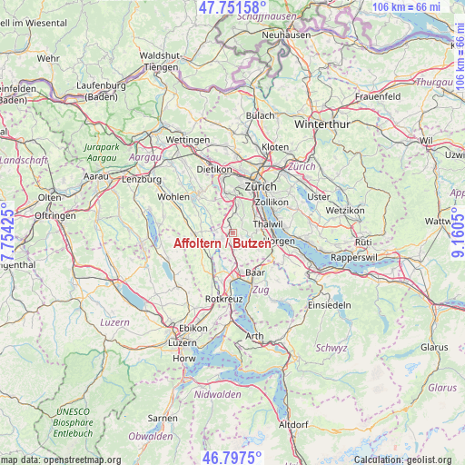
Affoltern / Butzen GPS coordinates[2]
47° 16' 36.084" North, 8° 27' 26.532" East
| Map corner | latitude | longitude |
|---|---|---|
| Upper-left | 47.75158°, | 7.75425° |
| Center: | 47.27669°, | 8.45737° |
| Lower-right: | 46.7975°, | 9.1605° |
| Map W x H: | 106.1×106.1 km | = 65.9×65.9mi |
| max Lat: | 47.76737° ⇑44.6% North |
| Affoltern / Butzen: | 47.27669° |
| min Lat: | ⇓55.4% South 45.83203° |
| min Long | Affoltern / But | max Long |
| 5.97153° | 8.45737° | 10.44624° |
| W 53.8%⇐ | ⇒46.2% E |
Elevation
Elevation of Affoltern / Butzen is 517 m = 1696 ft, and this is 41.2 m = 135 ft below average elevation for this country.
| Max E: |
1845 m = 6053 ft | 40.2% |
| Avg. | 558.2 m = 1831 ft | |
| Affoltern / Butzen | 517 m = 1696 ft | |
Min E: |
197 m = 646 ft | 59.8% |
See also: Switzerland elevation on elevation.city.
Geographical zone
Affoltern / Butzen is located in North temperate zone (between Tropic of Cancer and the Arctic Circle). Distance of this North polar circle is 2144.5 km =1332.5 mi to North.| Distance of | km | miles | from Affoltern / Butzen |
|---|---|---|---|
| North Pole | 4750.4 | 2951.8 | to North |
| Arctic Circle | 2144.5 | 1332.5 | to North |
| Tropic Cancer | 2650.8 | 1647.1 | to South |
| Equator | 5256.7 | 3266.4 | to South |


Nearby cities:
15 places around Affoltern / Butzen: (largest is in red/bold)
• Aeugst / Aeugst (Dorf)
2.2 km =1.4 mi,  111°
111°
• Aeugst am Albis
2.4 km =1.5 mi,  116°
116°
• Affoltern / Goldiger Berg
0.9 km =0.6 mi,  282°
282°
• Affoltern / Hasenbüel
0.5 km =0.3 mi,  225°
225°
• Affoltern / Oberdorf
0.2 km =0.1 mi,  342°
342°
• Affoltern / Sonnenberg
0.5 km =0.3 mi,  25°
25°
• Affoltern / Unterdorf
0.7 km =0.4 mi, 339°
• Affoltern am Albis
0.5 km =0.3 mi, 280°
• Hedingen
2.5 km =1.6 mi, 343°
• Mettmenstetten
3.5 km =2.2 mi,  172°
172°
• Obfelden
3 km =1.9 mi,  242°
242°
• Obfelden / Bickwil
2.6 km =1.6 mi,  251°
251°
• Obfelden / Oberlunnern
3.5 km =2.2 mi, 242°
• Obfelden / Toussen
2.4 km =1.5 mi, 239°
• Zwillikon
2.4 km =1.5 mi,  303°
303°
Sources, notices
• [Note1] Compared only with cities in Switzerland existing in our database
• [Src1] Map data: © OpenStreetMap contributors (CC-BY-SA)
• [Src2] Other city data from geonames.org with taken over terms of usage.
• [Src3] Geographical zone / Annual Mean Temperature by Robert A. Rohde @ Wikipedia
