Mettmenstetten geodata
Mettmenstetten (Zurich) is a section of populated place; located in Switzerland in Europe/Zurich (GMT+2) time zone. With population of 2,798 people, there are 631 cities with bigger population in this country. Compared to other cities in Switzerland, 51.3% of cities are located further ↓South; 54.5% of cities are located further ←West and 52.4% of cities have higher elevation than Mettmenstetten. Note1


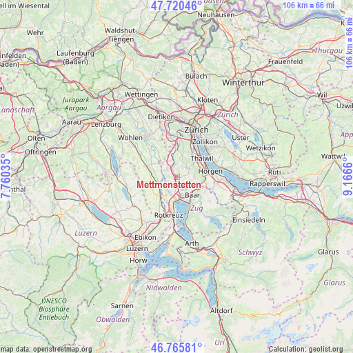
Mettmenstetten GPS coordinates[2]
47° 14' 43.044" North, 8° 27' 48.492" East
| Map corner | latitude | longitude |
|---|---|---|
| Upper-left | 47.72046°, | 7.76035° |
| Center: | 47.24529°, | 8.46347° |
| Lower-right: | 46.76581°, | 9.1666° |
| Map W x H: | 106.1×106.1 km | = 65.9×65.9mi |
| max Lat: | 47.76737° ⇑48.7% North |
| Mettmenstetten: | 47.24529° |
| min Lat: | ⇓51.3% South 45.83203° |
| min Long | Mettmenstetten | max Long |
| 5.97153° | 8.46347° | 10.44624° |
| W 54.5%⇐ | ⇒45.5% E |
Elevation
Elevation of Mettmenstetten is 473 m = 1552 ft, and this is 85.2 m = 280 ft below average elevation for this country.
| Max E: |
1845 m = 6053 ft | 52.4% |
| Avg. | 558.2 m = 1831 ft | |
| Mettmenstetten | 473 m = 1552 ft | |
Min E: |
197 m = 646 ft | 47.6% |
See also: Switzerland elevation on elevation.city.
Geographical zone
Mettmenstetten is located in North temperate zone (between Tropic of Cancer and the Arctic Circle). Distance of this North polar circle is 2148 km =1334.7 mi to North.| Distance of | km | miles | from Mettmenstetten |
|---|---|---|---|
| North Pole | 4753.9 | 2953.9 | to North |
| Arctic Circle | 2148 | 1334.7 | to North |
| Tropic Cancer | 2647.3 | 1645 | to South |
| Equator | 5253.2 | 3264.2 | to South |


Nearby cities:
15 places around Mettmenstetten: (largest is in red/bold)
• Aeugst / Aeugst (Dorf)
3.1 km =1.9 mi,  31°
31°
• Aeugst am Albis
2.9 km =1.8 mi, 34°
• Affoltern / Butzen
3.5 km =2.2 mi,  352°
352°
• Affoltern / Goldiger Berg
3.9 km =2.4 mi,  339°
339°
• Affoltern / Hasenbüel
3.2 km =2 mi, 344°
• Affoltern / Oberdorf
3.7 km =2.3 mi, 351°
• Affoltern / Sonnenberg
3.9 km =2.4 mi,  356°
356°
• Affoltern / Unterdorf
4.2 km =2.6 mi, 350°
• Affoltern am Albis
3.7 km =2.3 mi, 345°
• Knonau
2.4 km =1.5 mi,  182°
182°
• Obfelden
3.8 km =2.4 mi,  303°
303°
• Obfelden / Bickwil
4 km =2.5 mi,  312°
312°
• Obfelden / Oberlunnern
4 km =2.5 mi, 297°
• Obfelden / Toussen
3.4 km =2.1 mi, 312°
• Rifferswil
2.5 km =1.6 mi,  93°
93°
Sources, notices
• [Note1] Compared only with cities in Switzerland existing in our database
• [Src1] Map data: © OpenStreetMap contributors (CC-BY-SA)
• [Src2] Other city data from geonames.org with taken over terms of usage.
• [Src3] Geographical zone / Annual Mean Temperature by Robert A. Rohde @ Wikipedia
