Samatiguila geodata
Samatiguila (Denguélé) is a seat of a third-order administrative division; located in Ivory Coast in Africa/Abidjan (GMT+0) time zone. In our database, there are 63 cities with bigger population. Compared to other cities in Ivory Coast, 95.7% of cities are located further ↓South; 89.7% of cities are located further →East and 88.9% of cities have lower elevation than Samatiguila. Note1


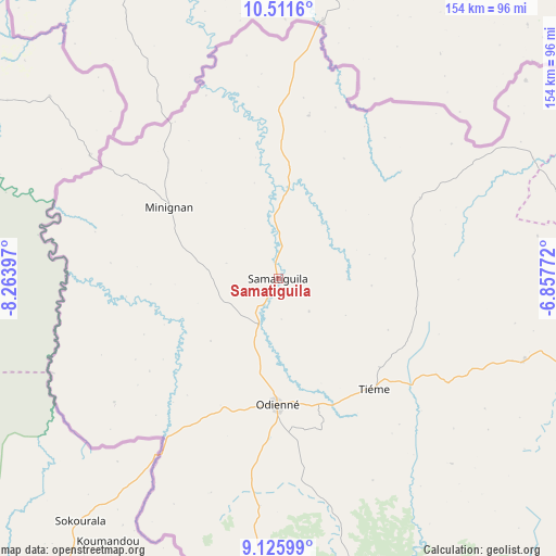
Samatiguila GPS coordinates[2]
9° 49' 10.272" North, 7° 33' 39.06" West
| Map corner | latitude | longitude |
|---|---|---|
| Upper-left | 10.5116°, | -8.26397° |
| Center: | 9.81952°, | -7.56085° |
| Lower-right: | 9.12599°, | -6.85772° |
| Map W x H: | 154.1×154.1 km | = 95.8×95.8mi |
| max Lat: | 10.48115° ⇑4.3% North |
| Samatiguila: | 9.81952° |
| min Lat: | ⇓95.7% South 4.42295° |
| min Long | Samatiguila | max Long |
| -8.42592° | -7.56085° | -2.80003° |
| W 10.3%⇐ | ⇒89.7% E |
Elevation
Elevation of Samatiguila is 386 m = 1266 ft, and this is 161.7 m = 531 ft above average elevation for this country.
| Max E: |
556 m = 1824 ft | 11.1% |
| Samatiguila | 386 m 1266 ft | |
| Avg. | 224.3 m = 736 ft | |
Min E: |
7 m = 23 ft | 88.9% |
See also: Ivory Coast elevation on elevation.city.
Geographical zone
Samatiguila is located in North Torrid zone (between Equator and Tropic of Cancer). Distance of Equator is 1091.8 km =678.4 mi to South.| Distance of | km | miles | from Samatiguila |
|---|---|---|---|
| North Pole | 8915.2 | 5539.6 | to North |
| Arctic Circle | 6309.3 | 3920.4 | to North |
| Tropic Cancer | 1514.1 | 940.8 | to North |
| Equator | 1091.8 | 678.4 | to South |


Nearby cities:
15 places around Samatiguila: (largest is in red/bold)
• Boundiali
122.3 km =76 mi,  105°
105°
• Dianra
173.3 km =107.7 mi,  124°
124°
• Gbéléban
67.8 km =42.1 mi,  247°
247°
• Kani
182.4 km =113.3 mi,  144°
144°
• Kaniasso
5.3 km =3.3 mi,  95°
95°
• Koro
141 km =87.6 mi,  175°
175°
• Kouto
126.4 km =78.5 mi,  86°
86°
• Madinani
71.7 km =44.6 mi, 108°
• Minignan
36 km =22.4 mi,  303°
303°
• M’Bengué
183 km =113.7 mi,  83°
83°
• Odienné
35 km =21.7 mi, 180°
• Ouaninou
179 km =111.2 mi,  190°
190°
• Séguélon
70.5 km =43.8 mi, 136°
• Tengréla
146.2 km =90.8 mi,  59°
59°
• Touba
171.3 km =106.4 mi, 184°
Sources, notices
• [Note1] Compared only with cities in Ivory Coast existing in our database
• [Src1] Map data: © OpenStreetMap contributors (CC-BY-SA)
• [Src2] Other city data from geonames.org with taken over terms of usage.
• [Src3] Geographical zone / Annual Mean Temperature by Robert A. Rohde @ Wikipedia
