Tengréla geodata
Tengréla (Savanes) is a seat of a third-order administrative division; located in Ivory Coast in Africa/Abidjan (GMT+0) time zone. With population of 39,277 people, there are 31 cities with bigger population in this country. Compared to other cities in Ivory Coast, 100% of cities are located further ↓South; 69.2% of cities are located further →East and 86.3% of cities have lower elevation than Tengréla. Note1


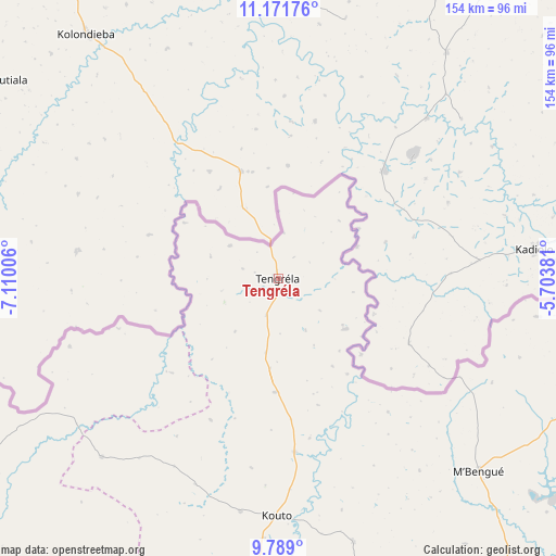
Tengréla GPS coordinates[2]
10° 28' 52.14" North, 6° 24' 24.984" West
| Map corner | latitude | longitude |
|---|---|---|
| Upper-left | 11.17176°, | -7.11006° |
| Center: | 10.48115°, | -6.40694° |
| Lower-right: | 9.789°, | -5.70381° |
| Map W x H: | 153.7×153.8 km | = 95.5×95.6mi |
| max Lat: | 10.48115° ⇑0% North |
| Tengréla: | 10.48115° |
| min Lat: | ⇓100% South 4.42295° |
| min Long | Tengréla | max Long |
| -8.42592° | -6.40694° | -2.80003° |
| W 30.8%⇐ | ⇒69.2% E |
Elevation
Elevation of Tengréla is 370 m = 1214 ft, and this is 145.7 m = 478 ft above average elevation for this country.
| Max E: |
556 m = 1824 ft | 13.7% |
| Tengréla | 370 m 1214 ft | |
| Avg. | 224.3 m = 736 ft | |
Min E: |
7 m = 23 ft | 86.3% |
See also: Ivory Coast elevation on elevation.city.
Geographical zone
Tengréla is located in North Torrid zone (between Equator and Tropic of Cancer). Distance of Equator is 1165.4 km =724.1 mi to South.| Distance of | km | miles | from Tengréla |
|---|---|---|---|
| North Pole | 8841.7 | 5494 | to North |
| Arctic Circle | 6235.8 | 3874.7 | to North |
| Tropic Cancer | 1440.5 | 895.1 | to North |
| Equator | 1165.4 | 724.1 | to South |


Nearby cities:
15 places around Tengréla: (largest is in red/bold)
• Boundiali
107 km =66.5 mi,  184°
184°
• Dianra
171.8 km =106.8 mi,  174°
174°
• Dikodougou
171.9 km =106.8 mi,  156°
156°
• Ferkessédougou
165.5 km =102.8 mi,  126°
126°
• Kaniasso
141.9 km =88.2 mi,  238°
238°
• Korhogo
142.1 km =88.3 mi,  143°
143°
• Kouto
65.7 km =40.8 mi, 180°
• Madinani
113.1 km =70.3 mi,  211°
211°
• Minignan
165.3 km =102.7 mi,  251°
251°
• M’Bengué
76.8 km =47.7 mi, 133°
• Odienné
166.9 km =103.7 mi,  229°
229°
• Ouangolodougou
149 km =92.6 mi,  112°
112°
• Samatiguila
146.2 km =90.8 mi, 239°
• Sinématiali
149.9 km =93.1 mi, 131°
• Séguélon
147.4 km =91.6 mi, 212°
Sources, notices
• [Note1] Compared only with cities in Ivory Coast existing in our database
• [Src1] Map data: © OpenStreetMap contributors (CC-BY-SA)
• [Src2] Other city data from geonames.org with taken over terms of usage.
• [Src3] Geographical zone / Annual Mean Temperature by Robert A. Rohde @ Wikipedia
