Zhuting geodata
Zhuting (Jiangxi) is a seat of a fourth-order administrative division; located in China in Asia/Shanghai (GMT+8) time zone. In our database, there are 1268 cities with bigger population. Compared to other cities in China, 75.3% of cities are located further ↑North; 50.8% of cities are located further →East and 56.1% of cities have higher elevation than Zhuting. Note1


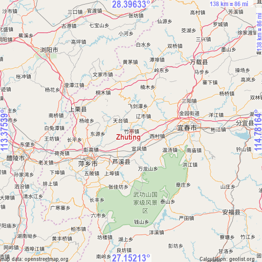
Zhuting GPS coordinates[2]
27° 46' 33.636" North, 114° 4' 42.636" East
| Map corner | latitude | longitude |
|---|---|---|
| Upper-left | 28.39633°, | 113.37539° |
| Center: | 27.77601°, | 114.07851° |
| Lower-right: | 27.15213°, | 114.78164° |
| Map W x H: | 138.3×138.3 km | = 85.9×85.9mi |
| max Lat: | 53.31946° ⇑75.3% North |
| Zhuting: | 27.77601° |
| min Lat: | ⇓24.7% South 18.22056° |
| min Long | Zhuting | max Long |
| 75.07348° | 114.07851° | 134.28917° |
| W 49.2%⇐ | ⇒50.8% E |
Elevation
Elevation of Zhuting is 123 m = 404 ft, and this is 361.8 m = 1187 ft below average elevation for this country.
| Max E: |
5622 m = 18445 ft | 56.1% |
| Avg. | 484.8 m = 1591 ft | |
| Zhuting | 123 m = 404 ft | |
Min E: |
-3 m = -10 ft | 43.9% |
See also: China elevation on elevation.city.
Geographical zone
Zhuting is located in North temperate zone (between Tropic of Cancer and the Arctic Circle). Distance of this Northern Tropic circle is 482.5 km =299.8 mi to South.| Distance of | km | miles | from Zhuting |
|---|---|---|---|
| North Pole | 6918.7 | 4299.1 | to North |
| Arctic Circle | 4312.8 | 2679.8 | to North |
| Tropic Cancer | 482.5 | 299.8 | to South |
| Equator | 3088.4 | 1919 | to South |


Nearby cities:
15 places around Zhuting: (largest is in red/bold)
• Feijiantan
13.9 km =8.6 mi,  14°
14°
• Huayun
22.9 km =14.2 mi,  165°
165°
• Jinrui
20.7 km =12.9 mi,  35°
35°
• Luxi
16.1 km =10 mi,  195°
195°
• Nanmu
25.1 km =15.6 mi,  20°
20°
• Raoshi
10.4 km =6.5 mi, 37°
• Tiantai
8.3 km =5.2 mi,  315°
315°
• Tiantaishan
14.4 km =8.9 mi,  327°
327°
• Wanlongshan
21.3 km =13.2 mi,  155°
155°
• Wentang
22.4 km =13.9 mi,  114°
114°
• Xicun
13.9 km =8.6 mi,  99°
99°
• Xintian
18.5 km =11.5 mi,  72°
72°
• Xuanfeng
9.8 km =6.1 mi, 155°
• Yinhe
9.3 km =5.8 mi, 155°
• Yuannan
12.6 km =7.8 mi, 201°
Sources, notices
• [Note1] Compared only with cities in China existing in our database
• [Src1] Map data: © OpenStreetMap contributors (CC-BY-SA)
• [Src2] Other city data from geonames.org with taken over terms of usage.
• [Src3] Geographical zone / Annual Mean Temperature by Robert A. Rohde @ Wikipedia
