Zhongzhai geodata
Zhongzhai (Jiangxi) is a seat of a fourth-order administrative division; located in China in Asia/Shanghai (GMT+8) time zone. In our database, there are 1268 cities with bigger population. Compared to other cities in China, 87.4% of cities are located further ↑North; 51% of cities are located further ←West and 64.1% of cities have lower elevation than Zhongzhai. Note1


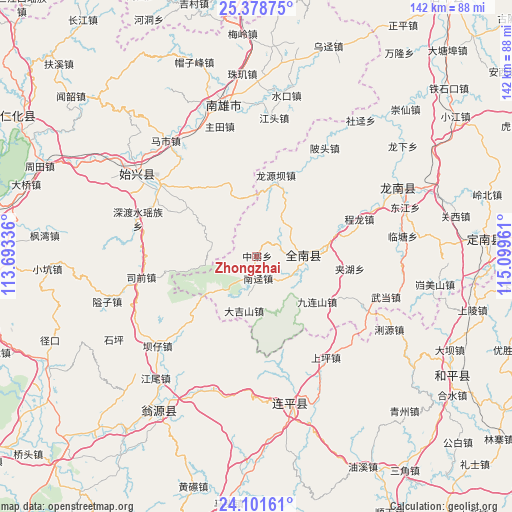
Zhongzhai GPS coordinates[2]
24° 44' 30.552" North, 114° 23' 47.328" East
| Map corner | latitude | longitude |
|---|---|---|
| Upper-left | 25.37875°, | 113.69336° |
| Center: | 24.74182°, | 114.39648° |
| Lower-right: | 24.10161°, | 115.09961° |
| Map W x H: | 142×142 km | = 88.2×88.2mi |
| max Lat: | 53.31946° ⇑87.4% North |
| Zhongzhai: | 24.74182° |
| min Lat: | ⇓12.6% South 18.22056° |
| min Long | Zhongzhai | max Long |
| 75.07348° | 114.39648° | 134.28917° |
| W 51%⇐ | ⇒49% E |
Elevation
Elevation of Zhongzhai is 312 m = 1024 ft, and this is 172.8 m = 567 ft below average elevation for this country.
| Max E: |
5622 m = 18445 ft | 35.9% |
| Avg. | 484.8 m = 1591 ft | |
| Zhongzhai | 312 m = 1024 ft | |
Min E: |
-3 m = -10 ft | 64.1% |
See also: China elevation on elevation.city.
Geographical zone
Zhongzhai is located in North temperate zone (between Tropic of Cancer and the Arctic Circle). Distance of this Northern Tropic circle is 145.1 km =90.2 mi to South.| Distance of | km | miles | from Zhongzhai |
|---|---|---|---|
| North Pole | 7256 | 4508.7 | to North |
| Arctic Circle | 4650.1 | 2889.4 | to North |
| Tropic Cancer | 145.1 | 90.2 | to South |
| Equator | 2751 | 1709.4 | to South |


Nearby cities:
15 places around Zhongzhai: (largest is in red/bold)
• Beitou
34.3 km =21.3 mi,  33°
33°
• Chengjiang
20.5 km =12.7 mi,  342°
342°
• Chenglong
30.1 km =18.7 mi,  70°
70°
• Dajishan
15.6 km =9.7 mi,  193°
193°
• Duheng
12.6 km =7.8 mi,  283°
283°
• Dujiang
33.6 km =20.9 mi, 65°
• Dungang
33.2 km =20.6 mi,  306°
306°
• Jiahu
26.1 km =16.2 mi,  97°
97°
• Jinlong
13.8 km =8.6 mi,  85°
85°
• Longyuanba
23 km =14.3 mi,  13°
13°
• Luoba
23.3 km =14.5 mi, 306°
• Nanjing
6.2 km =3.9 mi,  175°
175°
• Shendushui
32.3 km =20.1 mi,  285°
285°
• Siqian
32.3 km =20.1 mi,  255°
255°
• Yangcun
26.1 km =16.2 mi,  116°
116°
Sources, notices
• [Note1] Compared only with cities in China existing in our database
• [Src1] Map data: © OpenStreetMap contributors (CC-BY-SA)
• [Src2] Other city data from geonames.org with taken over terms of usage.
• [Src3] Geographical zone / Annual Mean Temperature by Robert A. Rohde @ Wikipedia
