Dungang geodata
Dungang (Guangdong) is a seat of a fourth-order administrative division; located in China in Asia/Shanghai (GMT+8) time zone. In our database, there are 1268 cities with bigger population. Compared to other cities in China, 86.7% of cities are located further ↑North; 50.5% of cities are located further →East and 57.4% of cities have higher elevation than Dungang. Note1


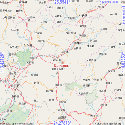
Dungang GPS coordinates[2]
24° 55' 5.124" North, 114° 7' 49.44" East
| Map corner | latitude | longitude |
|---|---|---|
| Upper-left | 25.5541°, | 113.42728° |
| Center: | 24.91809°, | 114.1304° |
| Lower-right: | 24.27878°, | 114.83353° |
| Map W x H: | 141.8×141.8 km | = 88.1×88.1mi |
| max Lat: | 53.31946° ⇑86.7% North |
| Dungang: | 24.91809° |
| min Lat: | ⇓13.3% South 18.22056° |
| min Long | Dungang | max Long |
| 75.07348° | 114.1304° | 134.28917° |
| W 49.5%⇐ | ⇒50.5% E |
Elevation
Elevation of Dungang is 115 m = 377 ft, and this is 369.8 m = 1213 ft below average elevation for this country.
| Max E: |
5622 m = 18445 ft | 57.4% |
| Avg. | 484.8 m = 1591 ft | |
| Dungang | 115 m = 377 ft | |
Min E: |
-3 m = -10 ft | 42.6% |
See also: China elevation on elevation.city.
Geographical zone
Dungang is located in North temperate zone (between Tropic of Cancer and the Arctic Circle). Distance of this Northern Tropic circle is 164.7 km =102.3 mi to South.| Distance of | km | miles | from Dungang |
|---|---|---|---|
| North Pole | 7236.4 | 4496.5 | to North |
| Arctic Circle | 4630.5 | 2877.3 | to North |
| Tropic Cancer | 164.7 | 102.3 | to South |
| Equator | 2770.6 | 1721.6 | to South |


Nearby cities:
15 places around Dungang: (largest is in red/bold)
• Cangshi
24.8 km =15.4 mi,  17°
17°
• Chengjiang
20.7 km =12.9 mi,  90°
90°
• Chengnan
7.7 km =4.8 mi,  278°
278°
• Duheng
22.1 km =13.7 mi,  138°
138°
• Gushi
19.4 km =12.1 mi,  37°
37°
• Luoba
9.9 km =6.2 mi,  125°
125°
• Mashi
12.5 km =7.8 mi,  8°
8°
• Quan’an
26.9 km =16.7 mi,  28°
28°
• Shendushui
11.7 km =7.3 mi,  201°
201°
• Shensuo
15.5 km =9.6 mi,  271°
271°
• Shixing
7.3 km =4.5 mi,  297°
297°
• Siqian
28.1 km =17.5 mi,  188°
188°
• Taiping
7.7 km =4.8 mi, 296°
• Xiongzhou
27.9 km =17.3 mi, 37°
• Zhutian
23.4 km =14.5 mi,  45°
45°
Sources, notices
• [Note1] Compared only with cities in China existing in our database
• [Src1] Map data: © OpenStreetMap contributors (CC-BY-SA)
• [Src2] Other city data from geonames.org with taken over terms of usage.
• [Src3] Geographical zone / Annual Mean Temperature by Robert A. Rohde @ Wikipedia
