Zhonghe geodata
Zhonghe (Ningxia Hui Autonomous Region) is a seat of a fourth-order administrative division; located in China in Asia/Shanghai (GMT+8) time zone. In our database, there are 1268 cities with bigger population. Compared to other cities in China, 77.3% of cities are located further ↓South; 86.2% of cities are located further →East and 93.4% of cities have lower elevation than Zhonghe. Note1


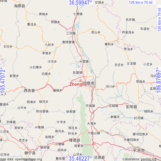
Zhonghe GPS coordinates[2]
36° 1' 58.512" North, 106° 10' 25.824" East
| Map corner | latitude | longitude |
|---|---|---|
| Upper-left | 36.59947°, | 105.47072° |
| Center: | 36.03292°, | 106.17384° |
| Lower-right: | 35.46227°, | 106.87697° |
| Map W x H: | 126.4×126.4 km | = 78.5×78.5mi |
| max Lat: | 53.31946° ⇑22.7% North |
| Zhonghe: | 36.03292° |
| min Lat: | ⇓77.3% South 18.22056° |
| min Long | Zhonghe | max Long |
| 75.07348° | 106.17384° | 134.28917° |
| W 13.8%⇐ | ⇒86.2% E |
Elevation
Elevation of Zhonghe is 1782 m = 5846 ft, and this is 1297.2 m = 4256 ft above average elevation for this country.
| Max E: |
5622 m = 18445 ft | 6.6% |
| Zhonghe | 1782 m 5846 ft | |
| Avg. | 484.8 m = 1591 ft | |
Min E: |
-3 m = -10 ft | 93.4% |
See also: China elevation on elevation.city.
Geographical zone
Zhonghe is located in North temperate zone (between Tropic of Cancer and the Arctic Circle). Distance of this Northern Tropic circle is 1400.6 km =870.3 mi to South.| Distance of | km | miles | from Zhonghe |
|---|---|---|---|
| North Pole | 6000.6 | 3728.6 | to North |
| Arctic Circle | 3394.7 | 2109.4 | to North |
| Tropic Cancer | 1400.6 | 870.3 | to South |
| Equator | 4006.5 | 2489.5 | to South |


Nearby cities:
15 places around Zhonghe: (largest is in red/bold)
• Bange
33.4 km =20.8 mi,  240°
240°
• Chengjiao
11.3 km =7 mi,  104°
104°
• Dongjiao
10.8 km =6.7 mi,  106°
106°
• Gonghe
17.8 km =11.1 mi,  76°
76°
• Guanting
26 km =16.2 mi,  56°
56°
• Gucheng
32.2 km =20 mi,  127°
127°
• Heiquan
8.2 km =5.1 mi,  8°
8°
• Huangduobu
31.9 km =19.8 mi,  342°
342°
• Jiaocha
32.8 km =20.4 mi,  67°
67°
• Pengbao
7 km =4.3 mi, 339°
• Piancheng
19.8 km =12.3 mi,  248°
248°
• Sanying
27.7 km =17.2 mi,  356°
356°
• Touying
15.2 km =9.4 mi,  15°
15°
• Xijiao
9.6 km =6 mi, 105°
• Yanglang
21.4 km =13.3 mi, 359°
Sources, notices
• [Note1] Compared only with cities in China existing in our database
• [Src1] Map data: © OpenStreetMap contributors (CC-BY-SA)
• [Src2] Other city data from geonames.org with taken over terms of usage.
• [Src3] Geographical zone / Annual Mean Temperature by Robert A. Rohde @ Wikipedia
