Huangduobu geodata
Huangduobu (Ningxia Hui Autonomous Region) is a seat of a fourth-order administrative division; located in China in Asia/Shanghai (GMT+8) time zone. In our database, there are 1268 cities with bigger population. Compared to other cities in China, 77.8% of cities are located further ↓South; 86.6% of cities are located further →East and 91.9% of cities have lower elevation than Huangduobu. Note1


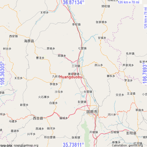
Huangduobu GPS coordinates[2]
36° 18' 24.408" North, 106° 3' 58.212" East
| Map corner | latitude | longitude |
|---|---|---|
| Upper-left | 36.87134°, | 105.36305° |
| Center: | 36.30678°, | 106.06617° |
| Lower-right: | 35.73811°, | 106.7693° |
| Map W x H: | 126×126 km | = 78.3×78.3mi |
| max Lat: | 53.31946° ⇑22.2% North |
| Huangduobu: | 36.30678° |
| min Lat: | ⇓77.8% South 18.22056° |
| min Long | Huangduobu | max Long |
| 75.07348° | 106.06617° | 134.28917° |
| W 13.4%⇐ | ⇒86.6% E |
Elevation
Elevation of Huangduobu is 1565 m = 5135 ft, and this is 1080.2 m = 3544 ft above average elevation for this country.
| Max E: |
5622 m = 18445 ft | 8.1% |
| Huangduobu | 1565 m 5135 ft | |
| Avg. | 484.8 m = 1591 ft | |
Min E: |
-3 m = -10 ft | 91.9% |
See also: China elevation on elevation.city.
Geographical zone
Huangduobu is located in North temperate zone (between Tropic of Cancer and the Arctic Circle). Distance of this Northern Tropic circle is 1431 km =889.2 mi to South.| Distance of | km | miles | from Huangduobu |
|---|---|---|---|
| North Pole | 5970.1 | 3709.6 | to North |
| Arctic Circle | 3364.2 | 2090.4 | to North |
| Tropic Cancer | 1431 | 889.2 | to South |
| Equator | 4036.9 | 2508.4 | to South |


Nearby cities:
15 places around Huangduobu: (largest is in red/bold)
• Gaotai
32 km =19.9 mi,  60°
60°
• Gongbailiang
23 km =14.3 mi,  70°
70°
• Guanting
35.1 km =21.8 mi,  117°
117°
• Heicheng
7.3 km =4.5 mi,  14°
14°
• Heiquan
24.8 km =15.4 mi,  154°
154°
• Luochuan
34.4 km =21.4 mi,  350°
350°
• Pengbao
25 km =15.5 mi,  163°
163°
• Qiying
23.1 km =14.4 mi,  18°
18°
• Sanying
8.5 km =5.3 mi,  109°
109°
• Tanshan
22.7 km =14.1 mi, 69°
• Touying
20.9 km =13 mi,  139°
139°
• Xinshan
28.5 km =17.7 mi,  79°
79°
• Yanglang
12.9 km =8 mi,  134°
134°
• Zhaike
32.1 km =19.9 mi,  93°
93°
• Zhonghe
31.9 km =19.8 mi, 162°
Sources, notices
• [Note1] Compared only with cities in China existing in our database
• [Src1] Map data: © OpenStreetMap contributors (CC-BY-SA)
• [Src2] Other city data from geonames.org with taken over terms of usage.
• [Src3] Geographical zone / Annual Mean Temperature by Robert A. Rohde @ Wikipedia
