Zhongjiapu geodata
Zhongjiapu (Hunan) is a seat of a fourth-order administrative division; located in China in Asia/Shanghai (GMT+8) time zone. In our database, there are 1268 cities with bigger population. Compared to other cities in China, 64.4% of cities are located further ↑North; 66.8% of cities are located further →East and 55.8% of cities have lower elevation than Zhongjiapu. Note1


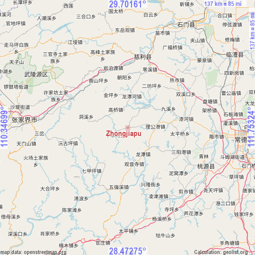
Zhongjiapu GPS coordinates[2]
29° 5' 20.436" North, 111° 3' 0.396" East
| Map corner | latitude | longitude |
|---|---|---|
| Upper-left | 29.70161°, | 110.34699° |
| Center: | 29.08901°, | 111.05011° |
| Lower-right: | 28.47275°, | 111.75324° |
| Map W x H: | 136.6×136.6 km | = 84.9×84.9mi |
| max Lat: | 53.31946° ⇑64.4% North |
| Zhongjiapu: | 29.08901° |
| min Lat: | ⇓35.6% South 18.22056° |
| min Long | Zhongjiapu | max Long |
| 75.07348° | 111.05011° | 134.28917° |
| W 33.2%⇐ | ⇒66.8% E |
Elevation
Elevation of Zhongjiapu is 214 m = 702 ft, and this is 270.8 m = 888 ft below average elevation for this country.
| Max E: |
5622 m = 18445 ft | 44.2% |
| Avg. | 484.8 m = 1591 ft | |
| Zhongjiapu | 214 m = 702 ft | |
Min E: |
-3 m = -10 ft | 55.8% |
See also: China elevation on elevation.city.
Geographical zone
Zhongjiapu is located in North temperate zone (between Tropic of Cancer and the Arctic Circle). Distance of this Northern Tropic circle is 628.5 km =390.5 mi to South.| Distance of | km | miles | from Zhongjiapu |
|---|---|---|---|
| North Pole | 6772.7 | 4208.4 | to North |
| Arctic Circle | 4166.8 | 2589.1 | to North |
| Tropic Cancer | 628.5 | 390.5 | to South |
| Equator | 3234.4 | 2009.8 | to South |


Nearby cities:
15 places around Zhongjiapu: (largest is in red/bold)
• Canmang
24.3 km =15.1 mi,  219°
219°
• Dongxi
22.6 km =14 mi,  285°
285°
• Gaoqiao
11.3 km =7 mi,  327°
327°
• Guanyinsi
19.5 km =12.1 mi,  169°
169°
• Huangjiapu
23.2 km =14.4 mi,  83°
83°
• Huangshi
17.5 km =10.9 mi,  53°
53°
• Jinglongqiao
24.2 km =15 mi,  10°
10°
• Jinping
19.7 km =12.2 mi, 333°
• Jiuxi
23.8 km =14.8 mi,  64°
64°
• Ligonggang
14.7 km =9.1 mi,  87°
87°
• Longtan
16.2 km =10.1 mi,  150°
150°
• Longtanhe
17.3 km =10.7 mi, 8°
• Niuchehe
8.6 km =5.3 mi,  238°
238°
• Shejiaping
23.2 km =14.4 mi,  122°
122°
• Wangjiaping
23.4 km =14.5 mi,  257°
257°
Sources, notices
• [Note1] Compared only with cities in China existing in our database
• [Src1] Map data: © OpenStreetMap contributors (CC-BY-SA)
• [Src2] Other city data from geonames.org with taken over terms of usage.
• [Src3] Geographical zone / Annual Mean Temperature by Robert A. Rohde @ Wikipedia
