Dongxi geodata
Dongxi (Hunan) is a seat of a fourth-order administrative division; located in China in Asia/Shanghai (GMT+8) time zone. In our database, there are 1268 cities with bigger population. Compared to other cities in China, 63.9% of cities are located further ↑North; 67.8% of cities are located further →East and 79.3% of cities have lower elevation than Dongxi. Note1


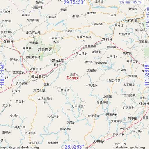
Dongxi GPS coordinates[2]
29° 8' 32.1" North, 110° 49' 30.216" East
| Map corner | latitude | longitude |
|---|---|---|
| Upper-left | 29.75453°, | 110.12194° |
| Center: | 29.14225°, | 110.82506° |
| Lower-right: | 28.5263°, | 111.52819° |
| Map W x H: | 136.6×136.6 km | = 84.9×84.9mi |
| max Lat: | 53.31946° ⇑63.9% North |
| Dongxi: | 29.14225° |
| min Lat: | ⇓36.1% South 18.22056° |
| min Long | Dongxi | max Long |
| 75.07348° | 110.82506° | 134.28917° |
| W 32.2%⇐ | ⇒67.8% E |
Elevation
Elevation of Dongxi is 663 m = 2175 ft, and this is 178.2 m = 585 ft above average elevation for this country.
| Max E: |
5622 m = 18445 ft | 20.7% |
| Dongxi | 663 m 2175 ft | |
| Avg. | 484.8 m = 1591 ft | |
Min E: |
-3 m = -10 ft | 79.3% |
See also: China elevation on elevation.city.
Geographical zone
Dongxi is located in North temperate zone (between Tropic of Cancer and the Arctic Circle). Distance of this Northern Tropic circle is 634.4 km =394.2 mi to South.| Distance of | km | miles | from Dongxi |
|---|---|---|---|
| North Pole | 6766.7 | 4204.6 | to North |
| Arctic Circle | 4160.9 | 2585.5 | to North |
| Tropic Cancer | 634.4 | 394.2 | to South |
| Equator | 3240.3 | 2013.4 | to South |


Nearby cities:
15 places around Dongxi: (largest is in red/bold)
• Ganyan
15.8 km =9.8 mi,  343°
343°
• Gaoqiao
16.2 km =10.1 mi,  77°
77°
• Jinping
17.4 km =10.8 mi,  47°
47°
• Nanshanping
20.6 km =12.8 mi,  18°
18°
• Niuchehe
17.9 km =11.1 mi,  125°
125°
• Shuangxiqiao
22.2 km =13.8 mi,  234°
234°
• Sigangtou
15.1 km =9.4 mi,  284°
284°
• Wangjiaping
10.9 km =6.8 mi,  185°
185°
• Xiejiaya
23.4 km =14.5 mi,  221°
221°
• Xikou
11.3 km =7 mi,  325°
325°
• Xujiafang
20 km =12.4 mi,  304°
304°
• Yanghe
18 km =11.2 mi,  319°
319°
• Yichongqiao
21.3 km =13.2 mi,  9°
9°
• Yuanguping
17.1 km =10.6 mi,  214°
214°
• Zhongjiapu
22.6 km =14 mi,  105°
105°
Sources, notices
• [Note1] Compared only with cities in China existing in our database
• [Src1] Map data: © OpenStreetMap contributors (CC-BY-SA)
• [Src2] Other city data from geonames.org with taken over terms of usage.
• [Src3] Geographical zone / Annual Mean Temperature by Robert A. Rohde @ Wikipedia
