Zhenqian geodata
Zhenqian (Fujian) is a seat of a fourth-order administrative division; located in China in Asia/Shanghai (GMT+8) time zone. In our database, there are 1268 cities with bigger population. Compared to other cities in China, 77.6% of cities are located further ↑North; 76.5% of cities are located further ←West and 84.7% of cities have lower elevation than Zhenqian. Note1


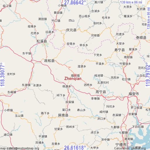
Zhenqian GPS coordinates[2]
27° 14' 35.016" North, 119° 5' 38.004" East
| Map corner | latitude | longitude |
|---|---|---|
| Upper-left | 27.86642°, | 118.39077° |
| Center: | 27.24306°, | 119.09389° |
| Lower-right: | 26.61618°, | 119.79702° |
| Map W x H: | 139×139 km | = 86.4×86.4mi |
| max Lat: | 53.31946° ⇑77.6% North |
| Zhenqian: | 27.24306° |
| min Lat: | ⇓22.4% South 18.22056° |
| min Long | Zhenqian | max Long |
| 75.07348° | 119.09389° | 134.28917° |
| W 76.5%⇐ | ⇒23.5% E |
Elevation
Elevation of Zhenqian is 960 m = 3150 ft, and this is 475.2 m = 1559 ft above average elevation for this country.
| Max E: |
5622 m = 18445 ft | 15.3% |
| Zhenqian | 960 m 3150 ft | |
| Avg. | 484.8 m = 1591 ft | |
Min E: |
-3 m = -10 ft | 84.7% |
See also: China elevation on elevation.city.
Geographical zone
Zhenqian is located in North temperate zone (between Tropic of Cancer and the Arctic Circle). Distance of this Northern Tropic circle is 423.2 km =263 mi to South.| Distance of | km | miles | from Zhenqian |
|---|---|---|---|
| North Pole | 6977.9 | 4335.9 | to North |
| Arctic Circle | 4372 | 2716.6 | to North |
| Tropic Cancer | 423.2 | 263 | to South |
| Equator | 3029.1 | 1882.2 | to South |


Nearby cities:
15 places around Zhenqian: (largest is in red/bold)
• Chengyuan
10.5 km =6.5 mi,  35°
35°
• Chunchi
21.7 km =13.5 mi,  89°
89°
• Limen
24.7 km =15.3 mi,  152°
152°
• Lingxia
22.7 km =14.1 mi,  215°
215°
• Lingyao
27.7 km =17.2 mi,  336°
336°
• Longxi
27.3 km =17 mi,  32°
32°
• Pingxi
25.2 km =15.7 mi,  64°
64°
• Puyuan
23.9 km =14.9 mi,  123°
123°
• Shuangxi
25.1 km =15.6 mi,  191°
191°
• Siqiao
14.8 km =9.2 mi,  126°
126°
• Tieshan
24 km =14.9 mi,  316°
316°
• Waitun
14.6 km =9.1 mi,  314°
314°
• Xingxi
27.1 km =16.8 mi,  300°
300°
• Xiongshan
27 km =16.8 mi, 299°
• Yangyuan
12.8 km =8 mi, 217°
Sources, notices
• [Note1] Compared only with cities in China existing in our database
• [Src1] Map data: © OpenStreetMap contributors (CC-BY-SA)
• [Src2] Other city data from geonames.org with taken over terms of usage.
• [Src3] Geographical zone / Annual Mean Temperature by Robert A. Rohde @ Wikipedia
