Waitun geodata
Waitun (Fujian) is a seat of a fourth-order administrative division; located in China in Asia/Shanghai (GMT+8) time zone. In our database, there are 1268 cities with bigger population. Compared to other cities in China, 77.3% of cities are located further ↑North; 76% of cities are located further ←West and 71.3% of cities have lower elevation than Waitun. Note1


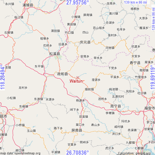
Waitun GPS coordinates[2]
27° 20' 4.992" North, 118° 59' 17.016" East
| Map corner | latitude | longitude |
|---|---|---|
| Upper-left | 27.95756°, | 118.28494° |
| Center: | 27.33472°, | 118.98806° |
| Lower-right: | 26.70836°, | 119.69119° |
| Map W x H: | 138.9×138.9 km | = 86.3×86.3mi |
| max Lat: | 53.31946° ⇑77.3% North |
| Waitun: | 27.33472° |
| min Lat: | ⇓22.7% South 18.22056° |
| min Long | Waitun | max Long |
| 75.07348° | 118.98806° | 134.28917° |
| W 76%⇐ | ⇒24% E |
Elevation
Elevation of Waitun is 437 m = 1434 ft, and this is 47.8 m = 157 ft below average elevation for this country.
| Max E: |
5622 m = 18445 ft | 28.7% |
| Avg. | 484.8 m = 1591 ft | |
| Waitun | 437 m = 1434 ft | |
Min E: |
-3 m = -10 ft | 71.3% |
See also: China elevation on elevation.city.
Geographical zone
Waitun is located in North temperate zone (between Tropic of Cancer and the Arctic Circle). Distance of this Northern Tropic circle is 433.4 km =269.3 mi to South.| Distance of | km | miles | from Waitun |
|---|---|---|---|
| North Pole | 6967.7 | 4329.5 | to North |
| Arctic Circle | 4361.8 | 2710.3 | to North |
| Tropic Cancer | 433.4 | 269.3 | to South |
| Equator | 3039.3 | 1888.5 | to South |


Nearby cities:
15 places around Waitun: (largest is in red/bold)
• Annan
20.3 km =12.6 mi,  18°
18°
• Chaping
23.4 km =14.5 mi,  313°
313°
• Chengyuan
16.6 km =10.3 mi,  95°
95°
• Jushui
25.6 km =15.9 mi,  45°
45°
• Lingxia
28.7 km =17.8 mi,  185°
185°
• Lingyao
15.3 km =9.5 mi,  357°
357°
• Longgong
17.8 km =11.1 mi,  345°
345°
• Longxi
28.2 km =17.5 mi,  63°
63°
• Shitun
23.4 km =14.5 mi,  276°
276°
• Tieshan
9.4 km =5.8 mi,  319°
319°
• Xingxi
13.3 km =8.3 mi,  285°
285°
• Xiongshan
13.3 km =8.3 mi, 284°
• Yangyuan
20.6 km =12.8 mi,  172°
172°
• Yushang
26.5 km =16.5 mi, 359°
• Zhenqian
14.6 km =9.1 mi,  134°
134°
Sources, notices
• [Note1] Compared only with cities in China existing in our database
• [Src1] Map data: © OpenStreetMap contributors (CC-BY-SA)
• [Src2] Other city data from geonames.org with taken over terms of usage.
• [Src3] Geographical zone / Annual Mean Temperature by Robert A. Rohde @ Wikipedia
