Chengyuan geodata
Chengyuan (Fujian) is a seat of a fourth-order administrative division; located in China in Asia/Shanghai (GMT+8) time zone. In our database, there are 1268 cities with bigger population. Compared to other cities in China, 77.3% of cities are located further ↑North; 76.8% of cities are located further ←West and 85.5% of cities have lower elevation than Chengyuan. Note1


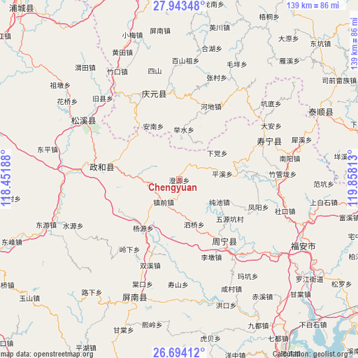
Chengyuan GPS coordinates[2]
27° 19' 14.016" North, 119° 9' 18" East
| Map corner | latitude | longitude |
|---|---|---|
| Upper-left | 27.94348°, | 118.45188° |
| Center: | 27.32056°, | 119.155° |
| Lower-right: | 26.69412°, | 119.85813° |
| Map W x H: | 138.9×138.9 km | = 86.3×86.3mi |
| max Lat: | 53.31946° ⇑77.3% North |
| Chengyuan: | 27.32056° |
| min Lat: | ⇓22.7% South 18.22056° |
| min Long | Chengyuan | max Long |
| 75.07348° | 119.155° | 134.28917° |
| W 76.8%⇐ | ⇒23.2% E |
Elevation
Elevation of Chengyuan is 1013 m = 3323 ft, and this is 528.2 m = 1733 ft above average elevation for this country.
| Max E: |
5622 m = 18445 ft | 14.5% |
| Chengyuan | 1013 m 3323 ft | |
| Avg. | 484.8 m = 1591 ft | |
Min E: |
-3 m = -10 ft | 85.5% |
See also: China elevation on elevation.city.
Geographical zone
Chengyuan is located in North temperate zone (between Tropic of Cancer and the Arctic Circle). Distance of this Northern Tropic circle is 431.8 km =268.3 mi to South.| Distance of | km | miles | from Chengyuan |
|---|---|---|---|
| North Pole | 6969.3 | 4330.5 | to North |
| Arctic Circle | 4363.4 | 2711.3 | to North |
| Tropic Cancer | 431.8 | 268.3 | to South |
| Equator | 3037.8 | 1887.6 | to South |


Nearby cities:
15 places around Chengyuan: (largest is in red/bold)
• Annan
23 km =14.3 mi,  334°
334°
• Chunchi
17.8 km =11.1 mi,  118°
118°
• Jushui
19.6 km =12.2 mi,  5°
5°
• Lingyao
24 km =14.9 mi,  314°
314°
• Longxi
16.7 km =10.4 mi,  31°
31°
• Pingxi
16.8 km =10.4 mi,  81°
81°
• Puyuan
25.9 km =16.1 mi,  147°
147°
• Qinyang
24.4 km =15.2 mi,  72°
72°
• Siqiao
18.3 km =11.4 mi,  161°
161°
• Tieshan
24.2 km =15 mi,  291°
291°
• Tuoxi
24.9 km =15.5 mi,  56°
56°
• Waitun
16.6 km =10.3 mi,  275°
275°
• Xiadang
17.7 km =11 mi, 56°
• Yangyuan
23.3 km =14.5 mi,  216°
216°
• Zhenqian
10.5 km =6.5 mi, 215°
Sources, notices
• [Note1] Compared only with cities in China existing in our database
• [Src1] Map data: © OpenStreetMap contributors (CC-BY-SA)
• [Src2] Other city data from geonames.org with taken over terms of usage.
• [Src3] Geographical zone / Annual Mean Temperature by Robert A. Rohde @ Wikipedia
