Zhangji geodata
Zhangji (Hubei) is a seat of a fourth-order administrative division; located in China in Asia/Shanghai (GMT+8) time zone. In our database, there are 1268 cities with bigger population. Compared to other cities in China, 58.5% of cities are located further ↓South; 58.8% of cities are located further →East and 55.4% of cities have higher elevation than Zhangji. Note1


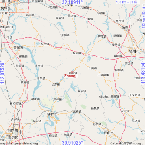
Zhangji GPS coordinates[2]
31° 30' 41.76" North, 112° 46' 42.276" East
| Map corner | latitude | longitude |
|---|---|---|
| Upper-left | 32.10911°, | 112.07529° |
| Center: | 31.5116°, | 112.77841° |
| Lower-right: | 30.91025°, | 113.48154° |
| Map W x H: | 133.3×133.3 km | = 82.8×82.8mi |
| max Lat: | 53.31946° ⇑41.5% North |
| Zhangji: | 31.5116° |
| min Lat: | ⇓58.5% South 18.22056° |
| min Long | Zhangji | max Long |
| 75.07348° | 112.77841° | 134.28917° |
| W 41.2%⇐ | ⇒58.8% E |
Elevation
Elevation of Zhangji is 129 m = 423 ft, and this is 355.8 m = 1167 ft below average elevation for this country.
| Max E: |
5622 m = 18445 ft | 55.4% |
| Avg. | 484.8 m = 1591 ft | |
| Zhangji | 129 m = 423 ft | |
Min E: |
-3 m = -10 ft | 44.6% |
See also: China elevation on elevation.city.
Geographical zone
Zhangji is located in North temperate zone (between Tropic of Cancer and the Arctic Circle). Distance of this Northern Tropic circle is 897.8 km =557.9 mi to South.| Distance of | km | miles | from Zhangji |
|---|---|---|---|
| North Pole | 6503.3 | 4041 | to North |
| Arctic Circle | 3897.4 | 2421.7 | to North |
| Tropic Cancer | 897.8 | 557.9 | to South |
| Equator | 3503.8 | 2177.2 | to South |


Nearby cities:
15 places around Zhangji: (largest is in red/bold)
• Banqiaodian
36.6 km =22.7 mi,  316°
316°
• Changgang
19.1 km =11.9 mi,  76°
76°
• Changshou
18.9 km =11.7 mi,  236°
236°
• Dongqiao
35.8 km =22.2 mi,  171°
171°
• Fengle
29.4 km =18.3 mi,  260°
260°
• Kedian
18.8 km =11.7 mi,  153°
153°
• Linkuang
41.7 km =25.9 mi,  234°
234°
• Liushui
31.9 km =19.8 mi,  281°
281°
• Lülin
35.9 km =22.3 mi,  127°
127°
• Pinglin
35.4 km =22 mi,  349°
349°
• Sanligang
28 km =17.4 mi,  94°
94°
• Shuanghe
18.4 km =11.4 mi,  10°
10°
• Yangji
38.5 km =23.9 mi, 147°
• Yangzi
28.1 km =17.5 mi,  209°
209°
• Zhongxiang
42.7 km =26.5 mi, 205°
Sources, notices
• [Note1] Compared only with cities in China existing in our database
• [Src1] Map data: © OpenStreetMap contributors (CC-BY-SA)
• [Src2] Other city data from geonames.org with taken over terms of usage.
• [Src3] Geographical zone / Annual Mean Temperature by Robert A. Rohde @ Wikipedia
