Fengle geodata
Fengle (Hubei) is a seat of a fourth-order administrative division; located in China in Asia/Shanghai (GMT+8) time zone. In our database, there are 1268 cities with bigger population. Compared to other cities in China, 58.1% of cities are located further ↓South; 60.2% of cities are located further →East and 68.7% of cities have higher elevation than Fengle. Note1


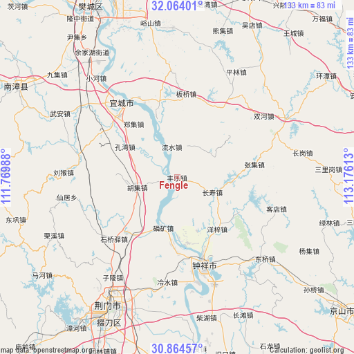
Fengle GPS coordinates[2]
31° 27' 58.356" North, 112° 28' 22.8" East
| Map corner | latitude | longitude |
|---|---|---|
| Upper-left | 32.06401°, | 111.76988° |
| Center: | 31.46621°, | 112.473° |
| Lower-right: | 30.86457°, | 113.17613° |
| Map W x H: | 133.4×133.4 km | = 82.9×82.9mi |
| max Lat: | 53.31946° ⇑41.9% North |
| Fengle: | 31.46621° |
| min Lat: | ⇓58.1% South 18.22056° |
| min Long | Fengle | max Long |
| 75.07348° | 112.473° | 134.28917° |
| W 39.8%⇐ | ⇒60.2% E |
Elevation
Elevation of Fengle is 57 m = 187 ft, and this is 427.8 m = 1404 ft below average elevation for this country.
| Max E: |
5622 m = 18445 ft | 68.7% |
| Avg. | 484.8 m = 1591 ft | |
| Fengle | 57 m = 187 ft | |
Min E: |
-3 m = -10 ft | 31.3% |
See also: China elevation on elevation.city.
Geographical zone
Fengle is located in North temperate zone (between Tropic of Cancer and the Arctic Circle). Distance of this Northern Tropic circle is 892.8 km =554.8 mi to South.| Distance of | km | miles | from Fengle |
|---|---|---|---|
| North Pole | 6508.3 | 4044.1 | to North |
| Arctic Circle | 3902.5 | 2424.9 | to North |
| Tropic Cancer | 892.8 | 554.8 | to South |
| Equator | 3498.7 | 2174 | to South |


Nearby cities:
15 places around Fengle: (largest is in red/bold)
• Banqiaodian
31.7 km =19.7 mi,  6°
6°
• Changshou
14.4 km =8.9 mi,  112°
112°
• Huji
15.4 km =9.6 mi,  256°
256°
• Kongwan
22.8 km =14.2 mi,  300°
300°
• Linkuang
19.7 km =12.2 mi,  195°
195°
• Liushui
11.5 km =7.1 mi,  348°
348°
• Nanying
34.4 km =21.4 mi,  330°
330°
• Shiqiaoyi
33.5 km =20.8 mi,  226°
226°
• Shuanghe
28.2 km =17.5 mi,  222°
222°
• Wenji
34.6 km =21.5 mi,  171°
171°
• Yangzi
24.6 km =15.3 mi,  141°
141°
• Yicheng
33.5 km =20.8 mi,  322°
322°
• Zhangji
29.4 km =18.3 mi,  80°
80°
• Zhengji
26 km =16.2 mi, 321°
• Zhongxiang
35 km =21.7 mi,  162°
162°
Sources, notices
• [Note1] Compared only with cities in China existing in our database
• [Src1] Map data: © OpenStreetMap contributors (CC-BY-SA)
• [Src2] Other city data from geonames.org with taken over terms of usage.
• [Src3] Geographical zone / Annual Mean Temperature by Robert A. Rohde @ Wikipedia
