Shuanghe geodata
Shuanghe (Hubei) is a seat of a fourth-order administrative division; located in China in Asia/Shanghai (GMT+8) time zone. In our database, there are 1268 cities with bigger population. Compared to other cities in China, 59.4% of cities are located further ↓South; 58.6% of cities are located further →East and 50.2% of cities have lower elevation than Shuanghe. Note1


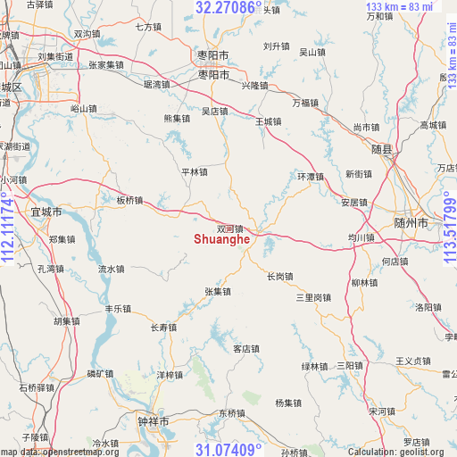
Shuanghe GPS coordinates[2]
31° 40' 27.84" North, 112° 48' 53.496" East
| Map corner | latitude | longitude |
|---|---|---|
| Upper-left | 32.27086°, | 112.11174° |
| Center: | 31.6744°, | 112.81486° |
| Lower-right: | 31.07409°, | 113.51799° |
| Map W x H: | 133.1×133.1 km | = 82.7×82.7mi |
| max Lat: | 53.31946° ⇑40.6% North |
| Shuanghe: | 31.6744° |
| min Lat: | ⇓59.4% South 18.22056° |
| min Long | Shuanghe | max Long |
| 75.07348° | 112.81486° | 134.28917° |
| W 41.4%⇐ | ⇒58.6% E |
Elevation
Elevation of Shuanghe is 167 m = 548 ft, and this is 317.8 m = 1043 ft below average elevation for this country.
| Max E: |
5622 m = 18445 ft | 49.8% |
| Avg. | 484.8 m = 1591 ft | |
| Shuanghe | 167 m = 548 ft | |
Min E: |
-3 m = -10 ft | 50.2% |
See also: China elevation on elevation.city.
Geographical zone
Shuanghe is located in North temperate zone (between Tropic of Cancer and the Arctic Circle). Distance of this Northern Tropic circle is 915.9 km =569.1 mi to South.| Distance of | km | miles | from Shuanghe |
|---|---|---|---|
| North Pole | 6485.2 | 4029.7 | to North |
| Arctic Circle | 3879.3 | 2410.5 | to North |
| Tropic Cancer | 915.9 | 569.1 | to South |
| Equator | 3521.9 | 2188.4 | to South |


Nearby cities:
15 places around Shuanghe: (largest is in red/bold)
• Anju
37.3 km =23.2 mi,  77°
77°
• Banqiaodian
29.8 km =18.5 mi,  286°
286°
• Changgang
20.4 km =12.7 mi,  132°
132°
• Changshou
34.4 km =21.4 mi,  213°
213°
• Fengle
39.8 km =24.7 mi,  234°
234°
• Junchuan
38.3 km =23.8 mi,  93°
93°
• Kedian
35.3 km =21.9 mi,  171°
171°
• Liushui
36.7 km =22.8 mi,  251°
251°
• Pinglin
19.5 km =12.1 mi,  329°
329°
• Sanligang
31.7 km =19.7 mi, 129°
• Wangcheng
33.6 km =20.9 mi,  20°
20°
• Wudian
34.6 km =21.5 mi,  353°
353°
• Xinjie
40.8 km =25.4 mi,  66°
66°
• Xiongji
34.8 km =21.6 mi, 334°
• Zhangji
18.4 km =11.4 mi,  190°
190°
Sources, notices
• [Note1] Compared only with cities in China existing in our database
• [Src1] Map data: © OpenStreetMap contributors (CC-BY-SA)
• [Src2] Other city data from geonames.org with taken over terms of usage.
• [Src3] Geographical zone / Annual Mean Temperature by Robert A. Rohde @ Wikipedia
