Yingchuan geodata
Yingchuan (Henan) is a seat of a third-order administrative division; located in China in Asia/Shanghai (GMT+8) time zone. With population of 87,961 people, there are 483 cities with bigger population in this country. Compared to other cities in China, 70.9% of cities are located further ↓South; 54.6% of cities are located further →East and 55.7% of cities have higher elevation than Yingchuan. Note1


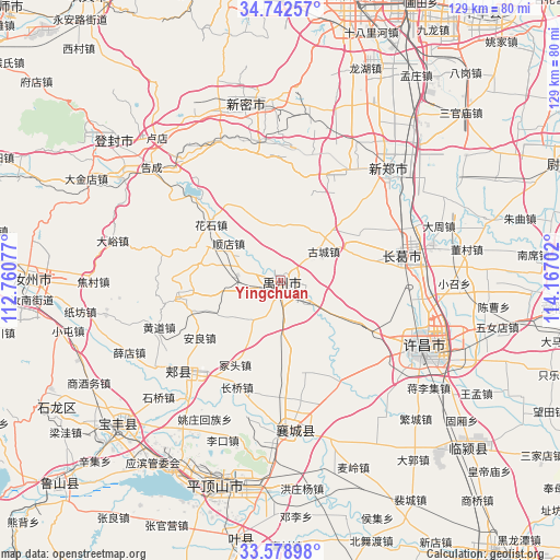
Yingchuan GPS coordinates[2]
34° 9' 46.008" North, 113° 27' 50.004" East
| Map corner | latitude | longitude |
|---|---|---|
| Upper-left | 34.74257°, | 112.76077° |
| Center: | 34.16278°, | 113.46389° |
| Lower-right: | 33.57898°, | 114.16702° |
| Map W x H: | 129.4×129.4 km | = 80.4×80.4mi |
| max Lat: | 53.31946° ⇑29.1% North |
| Yingchuan: | 34.16278° |
| min Lat: | ⇓70.9% South 18.22056° |
| min Long | Yingchuan | max Long |
| 75.07348° | 113.46389° | 134.28917° |
| W 45.4%⇐ | ⇒54.6% E |
Elevation
Elevation of Yingchuan is 126 m = 413 ft, and this is 358.8 m = 1177 ft below average elevation for this country.
| Max E: |
5622 m = 18445 ft | 55.7% |
| Avg. | 484.8 m = 1591 ft | |
| Yingchuan | 126 m = 413 ft | |
Min E: |
-3 m = -10 ft | 44.3% |
See also: Yingchuan elevation on elevation.city.
Geographical zone
Yingchuan is located in North temperate zone (between Tropic of Cancer and the Arctic Circle). Distance of this Northern Tropic circle is 1192.6 km =741 mi to South.| Distance of | km | miles | from Yingchuan |
|---|---|---|---|
| North Pole | 6208.5 | 3857.8 | to North |
| Arctic Circle | 3602.6 | 2238.6 | to North |
| Tropic Cancer | 1192.6 | 741 | to South |
| Equator | 3798.5 | 2360.3 | to South |


Nearby cities:
15 places around Yingchuan: (largest is in red/bold)
• Anliang
22.7 km =14.1 mi,  234°
234°
• Changqiao
27.3 km =17 mi,  202°
202°
• Fenchen
22.2 km =13.8 mi,  163°
163°
• Huangdao
30 km =18.6 mi,  249°
249°
• Jianshe
28.7 km =17.8 mi,  77°
77°
• Jiaxian
32 km =19.9 mi, 227°
• Kuzhuang
30.2 km =18.8 mi, 163°
• Shenjian
26.2 km =16.3 mi,  128°
128°
• Shilipu
31.4 km =19.5 mi,  185°
185°
• Shuangmiao
32.4 km =20.1 mi,  151°
151°
• Tangjie
32.5 km =20.2 mi, 204°
• Wangluo
21.7 km =13.5 mi,  176°
176°
• Yingqiao
24.8 km =15.4 mi, 153°
• Yingyang
27.2 km =16.9 mi, 149°
• Zhongtou
22.5 km =14 mi,  210°
210°
Sources, notices
• [Note1] Compared only with cities in China existing in our database
• [Src1] Map data: © OpenStreetMap contributors (CC-BY-SA)
• [Src2] Other city data from geonames.org with taken over terms of usage.
• [Src3] Geographical zone / Annual Mean Temperature by Robert A. Rohde @ Wikipedia
