Yuci geodata
Yuci (Shanxi) is a populated place; located in China in Asia/Shanghai (GMT+8) time zone. With population of 235,929 people, there are 209 cities with bigger population in this country. Compared to other cities in China, 80.6% of cities are located further ↓South; 59% of cities are located further →East and 82.2% of cities have lower elevation than Yuci. Note1


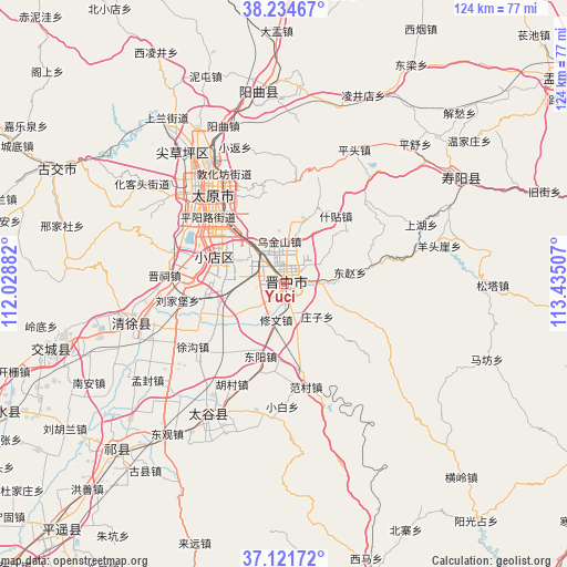
Yuci GPS coordinates[2]
37° 40' 49.008" North, 112° 43' 54.984" East
| Map corner | latitude | longitude |
|---|---|---|
| Upper-left | 38.23467°, | 112.02882° |
| Center: | 37.68028°, | 112.73194° |
| Lower-right: | 37.12172°, | 113.43507° |
| Map W x H: | 123.7×123.7 km | = 76.9×76.9mi |
| max Lat: | 53.31946° ⇑19.4% North |
| Yuci: | 37.68028° |
| min Lat: | ⇓80.6% South 18.22056° |
| min Long | Yuci | max Long |
| 75.07348° | 112.73194° | 134.28917° |
| W 41%⇐ | ⇒59% E |
Elevation
Elevation of Yuci is 798 m = 2618 ft, and this is 313.2 m = 1028 ft above average elevation for this country.
| Max E: |
5622 m = 18445 ft | 17.8% |
| Yuci | 798 m 2618 ft | |
| Avg. | 484.8 m = 1591 ft | |
Min E: |
-3 m = -10 ft | 82.2% |
See also: Yuci elevation on elevation.city.
Geographical zone
Yuci is located in North temperate zone (between Tropic of Cancer and the Arctic Circle). Distance of this Northern Tropic circle is 1583.7 km =984.1 mi to South.| Distance of | km | miles | from Yuci |
|---|---|---|---|
| North Pole | 5817.4 | 3614.8 | to North |
| Arctic Circle | 3211.5 | 1995.5 | to North |
| Tropic Cancer | 1583.7 | 984.1 | to South |
| Equator | 4189.7 | 2603.4 | to South |


Nearby cities:
15 places around Yuci: (largest is in red/bold)
• Chaicun
35.9 km =22.3 mi,  321°
321°
• Changning
10.6 km =6.6 mi,  106°
106°
• Chaoyang
44.6 km =27.7 mi,  55°
55°
• Dongzhao
10.3 km =6.4 mi,  81°
81°
• Huangzhai
44.4 km =27.6 mi,  351°
351°
• Jinyuan
23.5 km =14.6 mi,  282°
282°
• Julun
29.5 km =18.3 mi,  328°
328°
• Liuxiang
26.1 km =16.2 mi, 324°
• Mingxing
32.7 km =20.3 mi,  210°
210°
• Qianfeng
26.4 km =16.4 mi, 315°
• Qingyuan
36.4 km =22.6 mi,  258°
258°
• Taiyuan
25.9 km =16.1 mi, 324°
• Tianning
52.5 km =32.6 mi,  253°
253°
• Xiaodian
16.7 km =10.4 mi,  291°
291°
• Zhaoyu
51.5 km =32 mi,  225°
225°
Sources, notices
• [Note1] Compared only with cities in China existing in our database
• [Src1] Map data: © OpenStreetMap contributors (CC-BY-SA)
• [Src2] Other city data from geonames.org with taken over terms of usage.
• [Src3] Geographical zone / Annual Mean Temperature by Robert A. Rohde @ Wikipedia
