Jiachuan geodata
Jiachuan (Sichuan) is a seat of a fourth-order administrative division; located in China in Asia/Shanghai (GMT+8) time zone. In our database, there are 1268 cities with bigger population. Compared to other cities in China, 62.5% of cities are located further ↓South; 86.1% of cities are located further →East and 74% of cities have lower elevation than Jiachuan. Note1


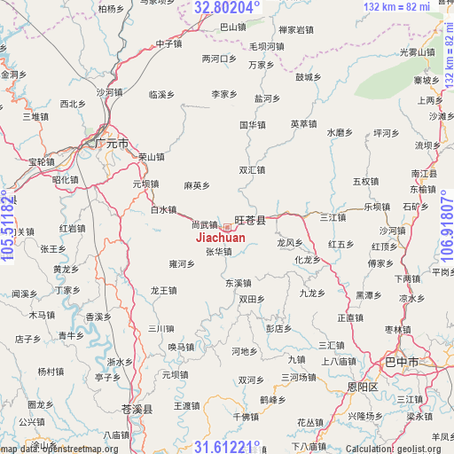
Jiachuan GPS coordinates[2]
32° 12' 32.652" North, 106° 12' 53.784" East
| Map corner | latitude | longitude |
|---|---|---|
| Upper-left | 32.80204°, | 105.51182° |
| Center: | 32.20907°, | 106.21494° |
| Lower-right: | 31.61221°, | 106.91807° |
| Map W x H: | 132.3×132.3 km | = 82.2×82.2mi |
| max Lat: | 53.31946° ⇑37.5% North |
| Jiachuan: | 32.20907° |
| min Lat: | ⇓62.5% South 18.22056° |
| min Long | Jiachuan | max Long |
| 75.07348° | 106.21494° | 134.28917° |
| W 13.9%⇐ | ⇒86.1% E |
Elevation
Elevation of Jiachuan is 500 m = 1640 ft, and this is 15.2 m = 50 ft above average elevation for this country.
| Max E: |
5622 m = 18445 ft | 26% |
| Jiachuan | 500 m 1640 ft | |
| Avg. | 484.8 m = 1591 ft | |
Min E: |
-3 m = -10 ft | 74% |
See also: China elevation on elevation.city.
Geographical zone
Jiachuan is located in North temperate zone (between Tropic of Cancer and the Arctic Circle). Distance of this Northern Tropic circle is 975.4 km =606.1 mi to South.| Distance of | km | miles | from Jiachuan |
|---|---|---|---|
| North Pole | 6425.7 | 3992.7 | to North |
| Arctic Circle | 3819.9 | 2373.6 | to North |
| Tropic Cancer | 975.4 | 606.1 | to South |
| Equator | 3581.3 | 2225.3 | to South |


Nearby cities:
15 places around Jiachuan: (largest is in red/bold)
• Baishui
19.5 km =12.1 mi,  286°
286°
• Donghe
8.6 km =5.3 mi,  71°
71°
• Dongxi
16.2 km =10.1 mi,  168°
168°
• Gaopo
17.5 km =10.9 mi,  138°
138°
• Hualong
24.9 km =15.5 mi,  110°
110°
• Huangmao
21.5 km =13.4 mi,  127°
127°
• Huangyang
14.8 km =9.2 mi,  77°
77°
• Longfeng
18.4 km =11.4 mi,  103°
103°
• Longwang
25.9 km =16.1 mi,  225°
225°
• Maying
15.3 km =9.5 mi,  324°
324°
• Puji
22.8 km =14.2 mi, 81°
• Shangwu
6.8 km =4.2 mi,  278°
278°
• Shima
29.7 km =18.5 mi, 137°
• Yuanba
27.1 km =16.8 mi,  298°
298°
• Zhanghua
7.4 km =4.6 mi,  202°
202°
Sources, notices
• [Note1] Compared only with cities in China existing in our database
• [Src1] Map data: © OpenStreetMap contributors (CC-BY-SA)
• [Src2] Other city data from geonames.org with taken over terms of usage.
• [Src3] Geographical zone / Annual Mean Temperature by Robert A. Rohde @ Wikipedia
