Shangwu geodata
Shangwu (Sichuan) is a seat of a fourth-order administrative division; located in China in Asia/Shanghai (GMT+8) time zone. In our database, there are 1268 cities with bigger population. Compared to other cities in China, 62.5% of cities are located further ↓South; 86.4% of cities are located further →East and 73.3% of cities have lower elevation than Shangwu. Note1


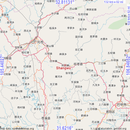
Shangwu GPS coordinates[2]
32° 13' 6.24" North, 106° 8' 36.204" East
| Map corner | latitude | longitude |
|---|---|---|
| Upper-left | 32.81131°, | 105.44027° |
| Center: | 32.2184°, | 106.14339° |
| Lower-right: | 31.6216°, | 106.84652° |
| Map W x H: | 132.3×132.3 km | = 82.2×82.2mi |
| max Lat: | 53.31946° ⇑37.5% North |
| Shangwu: | 32.2184° |
| min Lat: | ⇓62.5% South 18.22056° |
| min Long | Shangwu | max Long |
| 75.07348° | 106.14339° | 134.28917° |
| W 13.6%⇐ | ⇒86.4% E |
Elevation
Elevation of Shangwu is 481 m = 1578 ft, and this is 3.8 m = 12 ft below average elevation for this country.
| Max E: |
5622 m = 18445 ft | 26.7% |
| Avg. | 484.8 m = 1591 ft | |
| Shangwu | 481 m = 1578 ft | |
Min E: |
-3 m = -10 ft | 73.3% |
See also: China elevation on elevation.city.
Geographical zone
Shangwu is located in North temperate zone (between Tropic of Cancer and the Arctic Circle). Distance of this Northern Tropic circle is 976.4 km =606.7 mi to South.| Distance of | km | miles | from Shangwu |
|---|---|---|---|
| North Pole | 6424.7 | 3992.1 | to North |
| Arctic Circle | 3818.8 | 2372.9 | to North |
| Tropic Cancer | 976.4 | 606.7 | to South |
| Equator | 3582.4 | 2226 | to South |


Nearby cities:
15 places around Shangwu: (largest is in red/bold)
• Baishui
12.7 km =7.9 mi,  290°
290°
• Donghe
14.9 km =9.3 mi,  83°
83°
• Dongxi
19.6 km =12.2 mi,  149°
149°
• Gaopo
23.1 km =14.4 mi,  127°
127°
• Guohua
32.2 km =20 mi,  25°
25°
• Hualong
31.6 km =19.6 mi,  108°
108°
• Huangmao
27.7 km =17.2 mi,  120°
120°
• Huangyang
21.3 km =13.2 mi, 83°
• Jiachuan
6.8 km =4.2 mi,  98°
98°
• Longfeng
25.1 km =15.6 mi, 102°
• Longwang
22.5 km =14 mi,  211°
211°
• Maying
11.6 km =7.2 mi,  349°
349°
• Puji
29.4 km =18.3 mi,  85°
85°
• Yuanba
20.8 km =12.9 mi,  304°
304°
• Zhanghua
8.8 km =5.5 mi, 153°
Sources, notices
• [Note1] Compared only with cities in China existing in our database
• [Src1] Map data: © OpenStreetMap contributors (CC-BY-SA)
• [Src2] Other city data from geonames.org with taken over terms of usage.
• [Src3] Geographical zone / Annual Mean Temperature by Robert A. Rohde @ Wikipedia
