Yicheng geodata
Yicheng (Jiangsu) is a seat of a third-order administrative division; located in China in Asia/Shanghai (GMT+8) time zone. With population of 95,530 people, there are 441 cities with bigger population in this country. Compared to other cities in China, 57.5% of cities are located further ↓South; 80.7% of cities are located further ←West and 92.7% of cities have higher elevation than Yicheng. Note1


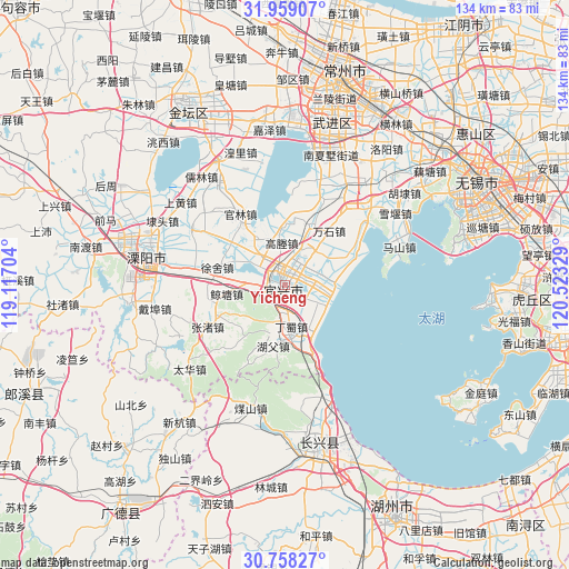
Yicheng GPS coordinates[2]
31° 21' 38.124" North, 119° 49' 12.576" East
| Map corner | latitude | longitude |
|---|---|---|
| Upper-left | 31.95907°, | 119.11704° |
| Center: | 31.36059°, | 119.82016° |
| Lower-right: | 30.75827°, | 120.52329° |
| Map W x H: | 133.5×133.5 km | = 83×83mi |
| max Lat: | 53.31946° ⇑42.5% North |
| Yicheng: | 31.36059° |
| min Lat: | ⇓57.5% South 18.22056° |
| min Long | Yicheng | max Long |
| 75.07348° | 119.82016° | 134.28917° |
| W 80.7%⇐ | ⇒19.3% E |
Elevation
Elevation of Yicheng is 8 m = 26 ft, and this is 476.8 m = 1564 ft below average elevation for this country.
| Max E: |
5622 m = 18445 ft | 92.7% |
| Avg. | 484.8 m = 1591 ft | |
| Yicheng | 8 m = 26 ft | |
Min E: |
-3 m = -10 ft | 7.3% |
See also: Yicheng elevation on elevation.city.
Geographical zone
Yicheng is located in North temperate zone (between Tropic of Cancer and the Arctic Circle). Distance of this Northern Tropic circle is 881.1 km =547.5 mi to South.| Distance of | km | miles | from Yicheng |
|---|---|---|---|
| North Pole | 6520.1 | 4051.4 | to North |
| Arctic Circle | 3914.2 | 2432.2 | to North |
| Tropic Cancer | 881.1 | 547.5 | to South |
| Equator | 3487 | 2166.7 | to South |


Nearby cities:
15 places around Yicheng: (largest is in red/bold)
• Dingshu
11.8 km =7.3 mi,  166°
166°
• Fangqiao
12.5 km =7.8 mi,  60°
60°
• Gaocheng
10.8 km =6.7 mi,  352°
352°
• Guanlin
19 km =11.8 mi,  327°
327°
• Heqiao
15.1 km =9.4 mi,  23°
23°
• Liangpeng
24.5 km =15.2 mi,  343°
343°
• Qiting
9.3 km =5.8 mi, 24°
• Wanshi
16.4 km =10.2 mi,  38°
38°
• Xinjie
6.8 km =4.2 mi,  277°
277°
• Xinzhuang
8.4 km =5.2 mi,  95°
95°
• Xizhu
25.3 km =15.7 mi,  251°
251°
• Xushe
16.6 km =10.3 mi, 283°
• Yangxiang
25.6 km =15.9 mi,  300°
300°
• Zhangzhu
20.9 km =13 mi,  240°
240°
• Zhoutie
18.8 km =11.7 mi, 62°
Sources, notices
• [Note1] Compared only with cities in China existing in our database
• [Src1] Map data: © OpenStreetMap contributors (CC-BY-SA)
• [Src2] Other city data from geonames.org with taken over terms of usage.
• [Src3] Geographical zone / Annual Mean Temperature by Robert A. Rohde @ Wikipedia
