Yangqiao geodata
Yangqiao (Jiangxi) is a seat of a fourth-order administrative division; located in China in Asia/Shanghai (GMT+8) time zone. In our database, there are 1268 cities with bigger population. Compared to other cities in China, 74.3% of cities are located further ↑North; 52% of cities are located further ←West and 60.3% of cities have higher elevation than Yangqiao. Note1


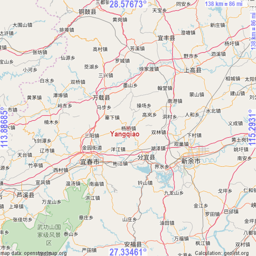
Yangqiao GPS coordinates[2]
27° 57' 26.856" North, 114° 35' 23.892" East
| Map corner | latitude | longitude |
|---|---|---|
| Upper-left | 28.57673°, | 113.88685° |
| Center: | 27.95746°, | 114.58997° |
| Lower-right: | 27.33461°, | 115.2931° |
| Map W x H: | 138.1×138.1 km | = 85.8×85.8mi |
| max Lat: | 53.31946° ⇑74.3% North |
| Yangqiao: | 27.95746° |
| min Lat: | ⇓25.7% South 18.22056° |
| min Long | Yangqiao | max Long |
| 75.07348° | 114.58997° | 134.28917° |
| W 52%⇐ | ⇒48% E |
Elevation
Elevation of Yangqiao is 97 m = 318 ft, and this is 387.8 m = 1272 ft below average elevation for this country.
| Max E: |
5622 m = 18445 ft | 60.3% |
| Avg. | 484.8 m = 1591 ft | |
| Yangqiao | 97 m = 318 ft | |
Min E: |
-3 m = -10 ft | 39.7% |
See also: China elevation on elevation.city.
Geographical zone
Yangqiao is located in North temperate zone (between Tropic of Cancer and the Arctic Circle). Distance of this Northern Tropic circle is 502.7 km =312.4 mi to South.| Distance of | km | miles | from Yangqiao |
|---|---|---|---|
| North Pole | 6898.5 | 4286.5 | to North |
| Arctic Circle | 4292.6 | 2667.3 | to North |
| Tropic Cancer | 502.7 | 312.4 | to South |
| Equator | 3108.6 | 1931.6 | to South |


Nearby cities:
15 places around Yangqiao: (largest is in red/bold)
• Baimu
16.3 km =10.1 mi,  287°
287°
• Binjiang
19.6 km =12.2 mi,  190°
190°
• Caochang
15 km =9.3 mi,  32°
32°
• Fengyang
11.9 km =7.4 mi,  154°
154°
• Fenyi
18 km =11.2 mi, 154°
• Gaolan
13.6 km =8.5 mi,  56°
56°
• Huze
18.8 km =11.7 mi,  122°
122°
• Kangle
20.6 km =12.8 mi,  318°
318°
• Lucun
13.6 km =8.5 mi,  255°
255°
• Sanyang
20.1 km =12.5 mi, 259°
• Shuanglin
16.4 km =10.2 mi,  96°
96°
• Tianxin
19.9 km =12.4 mi,  3°
3°
• Wojiang
19.9 km =12.4 mi,  229°
229°
• Yangjiang
12.5 km =7.8 mi,  206°
206°
• Zhaixia
10.9 km =6.8 mi,  302°
302°
Sources, notices
• [Note1] Compared only with cities in China existing in our database
• [Src1] Map data: © OpenStreetMap contributors (CC-BY-SA)
• [Src2] Other city data from geonames.org with taken over terms of usage.
• [Src3] Geographical zone / Annual Mean Temperature by Robert A. Rohde @ Wikipedia
