Xuyong geodata
Xuyong (Sichuan) is a seat of a third-order administrative division; located in China in Asia/Shanghai (GMT+8) time zone. In our database, there are 1268 cities with bigger population. Compared to other cities in China, 72.7% of cities are located further ↑North; 88.4% of cities are located further →East and 67.5% of cities have lower elevation than Xuyong. Note1


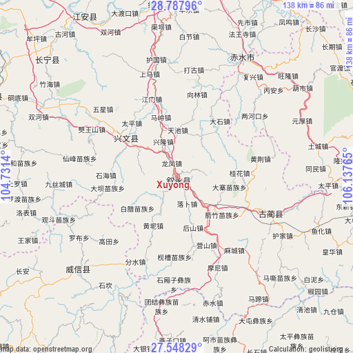
Xuyong GPS coordinates[2]
28° 10' 11.712" North, 105° 26' 4.272" East
| Map corner | latitude | longitude |
|---|---|---|
| Upper-left | 28.78796°, | 104.7314° |
| Center: | 28.16992°, | 105.43452° |
| Lower-right: | 27.54829°, | 106.13765° |
| Map W x H: | 137.8×137.8 km | = 85.6×85.6mi |
| max Lat: | 53.31946° ⇑72.7% North |
| Xuyong: | 28.16992° |
| min Lat: | ⇓27.3% South 18.22056° |
| min Long | Xuyong | max Long |
| 75.07348° | 105.43452° | 134.28917° |
| W 11.6%⇐ | ⇒88.4% E |
Elevation
Elevation of Xuyong is 367 m = 1204 ft, and this is 117.8 m = 386 ft below average elevation for this country.
| Max E: |
5622 m = 18445 ft | 32.5% |
| Avg. | 484.8 m = 1591 ft | |
| Xuyong | 367 m = 1204 ft | |
Min E: |
-3 m = -10 ft | 67.5% |
See also: China elevation on elevation.city.
Geographical zone
Xuyong is located in North temperate zone (between Tropic of Cancer and the Arctic Circle). Distance of this Northern Tropic circle is 526.3 km =327 mi to South.| Distance of | km | miles | from Xuyong |
|---|---|---|---|
| North Pole | 6874.9 | 4271.9 | to North |
| Arctic Circle | 4269 | 2652.6 | to North |
| Tropic Cancer | 526.3 | 327 | to South |
| Equator | 3132.2 | 1946.3 | to South |


Nearby cities:
15 places around Xuyong: (largest is in red/bold)
• Datong
43.8 km =27.2 mi,  32°
32°
• Gulin
39.5 km =24.5 mi,  111°
111°
• Gusong
25 km =15.5 mi,  309°
309°
• Qiaoshang
36.6 km =22.7 mi,  226°
226°
• Qingfenglin
51.1 km =31.8 mi,  213°
213°
• Sankoutang
55.4 km =34.4 mi,  238°
238°
• Shuitianzhai
48.5 km =30.1 mi,  201°
201°
• Tiantai
54.7 km =34 mi, 33°
• Tongmin
55 km =34.2 mi,  88°
88°
• Tucheng
56.5 km =35.1 mi,  76°
76°
• Yuanhou
56.3 km =35 mi,  70°
70°
• Zhaxi
57.9 km =36 mi, 232°
• Zhongba
45.5 km =28.3 mi, 238°
• Zhongcheng
25.3 km =15.7 mi, 307°
• Zoumachang
40.3 km =25 mi, 214°
Sources, notices
• [Note1] Compared only with cities in China existing in our database
• [Src1] Map data: © OpenStreetMap contributors (CC-BY-SA)
• [Src2] Other city data from geonames.org with taken over terms of usage.
• [Src3] Geographical zone / Annual Mean Temperature by Robert A. Rohde @ Wikipedia
