Tiantai geodata
Tiantai (Guizhou) is a seat of a fourth-order administrative division; located in China in Asia/Shanghai (GMT+8) time zone. In our database, there are 1268 cities with bigger population. Compared to other cities in China, 69.1% of cities are located further ↑North; 87.7% of cities are located further →East and 65.4% of cities have lower elevation than Tiantai. Note1


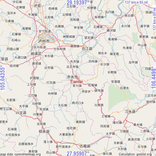
Tiantai GPS coordinates[2]
28° 34' 41.988" North, 105° 44' 48.012" East
| Map corner | latitude | longitude |
|---|---|---|
| Upper-left | 29.19397°, | 105.04355° |
| Center: | 28.57833°, | 105.74667° |
| Lower-right: | 27.95907°, | 106.4498° |
| Map W x H: | 137.3×137.3 km | = 85.3×85.3mi |
| max Lat: | 53.31946° ⇑69.1% North |
| Tiantai: | 28.57833° |
| min Lat: | ⇓30.9% South 18.22056° |
| min Long | Tiantai | max Long |
| 75.07348° | 105.74667° | 134.28917° |
| W 12.3%⇐ | ⇒87.7% E |
Elevation
Elevation of Tiantai is 333 m = 1093 ft, and this is 151.8 m = 498 ft below average elevation for this country.
| Max E: |
5622 m = 18445 ft | 34.6% |
| Avg. | 484.8 m = 1591 ft | |
| Tiantai | 333 m = 1093 ft | |
Min E: |
-3 m = -10 ft | 65.4% |
See also: China elevation on elevation.city.
Geographical zone
Tiantai is located in North temperate zone (between Tropic of Cancer and the Arctic Circle). Distance of this Northern Tropic circle is 571.7 km =355.2 mi to South.| Distance of | km | miles | from Tiantai |
|---|---|---|---|
| North Pole | 6829.4 | 4243.6 | to North |
| Arctic Circle | 4223.6 | 2624.4 | to North |
| Tropic Cancer | 571.7 | 355.2 | to South |
| Equator | 3177.6 | 1974.5 | to South |


Nearby cities:
15 places around Tiantai: (largest is in red/bold)
• Changqi
31.7 km =19.7 mi,  81°
81°
• Changsha
26.7 km =16.6 mi,  62°
62°
• Datong
10.9 km =6.8 mi,  218°
218°
• Fubao
38.5 km =23.9 mi, 56°
• Guandu
34.8 km =21.6 mi,  91°
91°
• Hejiang
27.3 km =17 mi,  18°
18°
• Luzhou
46.7 km =29 mi,  317°
317°
• Naxi
43.1 km =26.8 mi,  300°
300°
• Sanyuanchang
47.5 km =29.5 mi,  121°
121°
• Shima
48.7 km =30.3 mi, 20°
• Tongmin
50 km =31.1 mi,  150°
150°
• Tucheng
39.9 km =24.8 mi,  142°
142°
• Xiantan
51 km =31.7 mi, 58°
• Yuanhou
34.6 km =21.5 mi, 139°
• Zhutuo
49.9 km =31 mi,  11°
11°
Sources, notices
• [Note1] Compared only with cities in China existing in our database
• [Src1] Map data: © OpenStreetMap contributors (CC-BY-SA)
• [Src2] Other city data from geonames.org with taken over terms of usage.
• [Src3] Geographical zone / Annual Mean Temperature by Robert A. Rohde @ Wikipedia
