Zoumachang geodata
Zoumachang (Yunnan) is a seat of a fourth-order administrative division; located in China in Asia/Shanghai (GMT+8) time zone. In our database, there are 1268 cities with bigger population. Compared to other cities in China, 74.8% of cities are located further ↑North; 88.8% of cities are located further →East and 89.3% of cities have lower elevation than Zoumachang. Note1


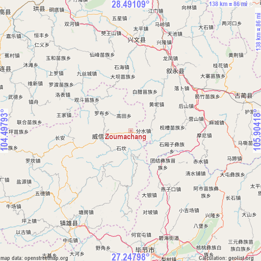
Zoumachang GPS coordinates[2]
27° 52' 16.752" North, 105° 12' 3.78" East
| Map corner | latitude | longitude |
|---|---|---|
| Upper-left | 28.49109°, | 104.49793° |
| Center: | 27.87132°, | 105.20105° |
| Lower-right: | 27.24798°, | 105.90418° |
| Map W x H: | 138.2×138.2 km | = 85.9×85.9mi |
| max Lat: | 53.31946° ⇑74.8% North |
| Zoumachang: | 27.87132° |
| min Lat: | ⇓25.2% South 18.22056° |
| min Long | Zoumachang | max Long |
| 75.07348° | 105.20105° | 134.28917° |
| W 11.2%⇐ | ⇒88.8% E |
Elevation
Elevation of Zoumachang is 1298 m = 4259 ft, and this is 813.2 m = 2668 ft above average elevation for this country.
| Max E: |
5622 m = 18445 ft | 10.7% |
| Zoumachang | 1298 m 4259 ft | |
| Avg. | 484.8 m = 1591 ft | |
Min E: |
-3 m = -10 ft | 89.3% |
See also: China elevation on elevation.city.
Geographical zone
Zoumachang is located in North temperate zone (between Tropic of Cancer and the Arctic Circle). Distance of this Northern Tropic circle is 493.1 km =306.4 mi to South.| Distance of | km | miles | from Zoumachang |
|---|---|---|---|
| North Pole | 6908.1 | 4292.5 | to North |
| Arctic Circle | 4302.2 | 2673.3 | to North |
| Tropic Cancer | 493.1 | 306.4 | to South |
| Equator | 3099 | 1925.6 | to South |


Nearby cities:
15 places around Zoumachang: (largest is in red/bold)
• Bijie
63.9 km =39.7 mi,  172°
172°
• Gulin
62.8 km =39 mi,  72°
72°
• Gusong
49.3 km =30.6 mi,  4°
4°
• Junlian
75.4 km =46.9 mi,  296°
296°
• Qiaoshang
8.7 km =5.4 mi,  335°
335°
• Qingfenglin
10.8 km =6.7 mi,  210°
210°
• Sankoutang
25.1 km =15.6 mi,  280°
280°
• Shuitianzhai
12.9 km =8 mi,  157°
157°
• Shuiying
40.2 km =25 mi,  260°
260°
• Wufeng
59.2 km =36.8 mi,  217°
217°
• Xuyong
40.3 km =25 mi,  34°
34°
• Yujiazhai
37.1 km =23.1 mi, 264°
• Zhaxi
22.9 km =14.2 mi, 264°
• Zhongba
18.3 km =11.4 mi, 300°
• Zhongcheng
48.8 km =30.3 mi, 3°
Sources, notices
• [Note1] Compared only with cities in China existing in our database
• [Src1] Map data: © OpenStreetMap contributors (CC-BY-SA)
• [Src2] Other city data from geonames.org with taken over terms of usage.
• [Src3] Geographical zone / Annual Mean Temperature by Robert A. Rohde @ Wikipedia
