Tongmin geodata
Tongmin (Guizhou) is a seat of a fourth-order administrative division; located in China in Asia/Shanghai (GMT+8) time zone. In our database, there are 1268 cities with bigger population. Compared to other cities in China, 72.6% of cities are located further ↑North; 86.9% of cities are located further →East and 71.3% of cities have lower elevation than Tongmin. Note1


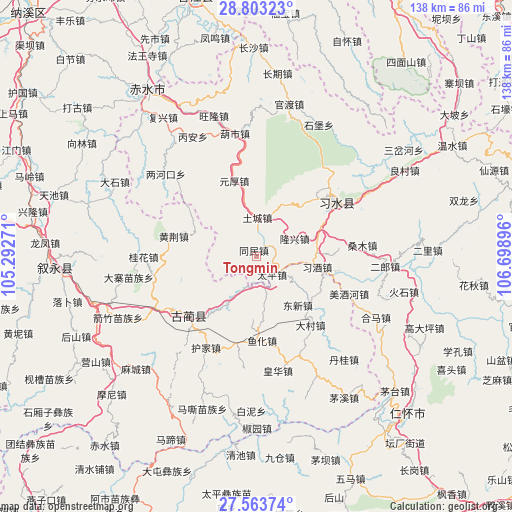
Tongmin GPS coordinates[2]
28° 11' 7.008" North, 105° 59' 44.988" East
| Map corner | latitude | longitude |
|---|---|---|
| Upper-left | 28.80323°, | 105.29271° |
| Center: | 28.18528°, | 105.99583° |
| Lower-right: | 27.56374°, | 106.69896° |
| Map W x H: | 137.8×137.8 km | = 85.6×85.6mi |
| max Lat: | 53.31946° ⇑72.6% North |
| Tongmin: | 28.18528° |
| min Lat: | ⇓27.4% South 18.22056° |
| min Long | Tongmin | max Long |
| 75.07348° | 105.99583° | 134.28917° |
| W 13.1%⇐ | ⇒86.9% E |
Elevation
Elevation of Tongmin is 436 m = 1430 ft, and this is 48.8 m = 160 ft below average elevation for this country.
| Max E: |
5622 m = 18445 ft | 28.7% |
| Avg. | 484.8 m = 1591 ft | |
| Tongmin | 436 m = 1430 ft | |
Min E: |
-3 m = -10 ft | 71.3% |
See also: China elevation on elevation.city.
Geographical zone
Tongmin is located in North temperate zone (between Tropic of Cancer and the Arctic Circle). Distance of this Northern Tropic circle is 528 km =328.1 mi to South.| Distance of | km | miles | from Tongmin |
|---|---|---|---|
| North Pole | 6873.2 | 4270.8 | to North |
| Arctic Circle | 4267.3 | 2651.6 | to North |
| Tropic Cancer | 528 | 328.1 | to South |
| Equator | 3133.9 | 1947.3 | to South |


Nearby cities:
15 places around Tongmin: (largest is in red/bold)
• Daba
46.4 km =28.8 mi,  113°
113°
• Dacun
23.6 km =14.7 mi,  140°
140°
• Datong
47 km =29.2 mi,  318°
318°
• Donghuang
27.1 km =16.8 mi,  52°
52°
• Guandu
43.9 km =27.3 mi,  13°
13°
• Gulin
24.2 km =15 mi,  228°
228°
• Hema
36.4 km =22.6 mi,  116°
116°
• Sangmu
27 km =16.8 mi,  82°
82°
• Sanhe
36.9 km =22.9 mi, 110°
• Sanyuanchang
24.7 km =15.3 mi,  40°
40°
• Shatan
27.8 km =17.3 mi, 107°
• Taiping
6.4 km =4 mi, 140°
• Tucheng
11.9 km =7.4 mi,  359°
359°
• Yong’an
42.1 km =26.2 mi,  87°
87°
• Yuanhou
17.4 km =10.8 mi,  353°
353°
Sources, notices
• [Note1] Compared only with cities in China existing in our database
• [Src1] Map data: © OpenStreetMap contributors (CC-BY-SA)
• [Src2] Other city data from geonames.org with taken over terms of usage.
• [Src3] Geographical zone / Annual Mean Temperature by Robert A. Rohde @ Wikipedia
