Zhongcheng geodata
Zhongcheng (Sichuan) is a seat of a third-order administrative division; located in China in Asia/Shanghai (GMT+8) time zone. In our database, there are 1268 cities with bigger population. Compared to other cities in China, 71.4% of cities are located further ↑North; 88.7% of cities are located further →East and 66.6% of cities have lower elevation than Zhongcheng. Note1


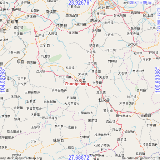
Zhongcheng GPS coordinates[2]
28° 18' 34.344" North, 105° 13' 50.7" East
| Map corner | latitude | longitude |
|---|---|---|
| Upper-left | 28.92676°, | 104.52763° |
| Center: | 28.30954°, | 105.23075° |
| Lower-right: | 27.68872°, | 105.93388° |
| Map W x H: | 137.7×137.7 km | = 85.6×85.6mi |
| max Lat: | 53.31946° ⇑71.4% North |
| Zhongcheng: | 28.30954° |
| min Lat: | ⇓28.6% South 18.22056° |
| min Long | Zhongcheng | max Long |
| 75.07348° | 105.23075° | 134.28917° |
| W 11.3%⇐ | ⇒88.7% E |
Elevation
Elevation of Zhongcheng is 354 m = 1161 ft, and this is 130.8 m = 429 ft below average elevation for this country.
| Max E: |
5622 m = 18445 ft | 33.4% |
| Avg. | 484.8 m = 1591 ft | |
| Zhongcheng | 354 m = 1161 ft | |
Min E: |
-3 m = -10 ft | 66.6% |
See also: China elevation on elevation.city.
Geographical zone
Zhongcheng is located in North temperate zone (between Tropic of Cancer and the Arctic Circle). Distance of this Northern Tropic circle is 541.8 km =336.7 mi to South.| Distance of | km | miles | from Zhongcheng |
|---|---|---|---|
| North Pole | 6859.3 | 4262.2 | to North |
| Arctic Circle | 4253.4 | 2642.9 | to North |
| Tropic Cancer | 541.8 | 336.7 | to South |
| Equator | 3147.7 | 1955.9 | to South |


Nearby cities:
15 places around Zhongcheng: (largest is in red/bold)
• Changning
42.5 km =26.4 mi,  314°
314°
• Datong
48.6 km =30.2 mi,  63°
63°
• Gusong
0.8 km =0.5 mi, 58°
• Jiang’an
49.7 km =30.9 mi,  341°
341°
• Naxi
53.3 km =33.1 mi,  14°
14°
• Qiaoshang
41.3 km =25.7 mi,  189°
189°
• Qingfenglin
58.6 km =36.4 mi, 188°
• Sankoutang
52 km =32.3 mi,  211°
211°
• Shuitianzhai
60.7 km =37.7 mi,  178°
178°
• Tiantai
58.6 km =36.4 mi, 59°
• Xunchang
53 km =32.9 mi,  287°
287°
• Xuyong
25.3 km =15.7 mi,  127°
127°
• Zhaxi
57.1 km =35.5 mi, 206°
• Zhongba
43.7 km =27.2 mi, 205°
• Zoumachang
48.8 km =30.3 mi, 183°
Sources, notices
• [Note1] Compared only with cities in China existing in our database
• [Src1] Map data: © OpenStreetMap contributors (CC-BY-SA)
• [Src2] Other city data from geonames.org with taken over terms of usage.
• [Src3] Geographical zone / Annual Mean Temperature by Robert A. Rohde @ Wikipedia
