Xinshi geodata
Xinshi (Hubei) is a seat of a third-order administrative division; located in China in Asia/Shanghai (GMT+8) time zone. With population of 98,422 people, there are 432 cities with bigger population in this country. Compared to other cities in China, 55.2% of cities are located further ↓South; 56.7% of cities are located further →East and 57.4% of cities have higher elevation than Xinshi. Note1


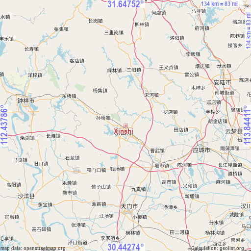
Xinshi GPS coordinates[2]
31° 2' 49.344" North, 113° 8' 27.528" East
| Map corner | latitude | longitude |
|---|---|---|
| Upper-left | 31.64752°, | 112.43786° |
| Center: | 31.04704°, | 113.14098° |
| Lower-right: | 30.44274°, | 113.84411° |
| Map W x H: | 134×134 km | = 83.3×83.3mi |
| max Lat: | 53.31946° ⇑44.8% North |
| Xinshi: | 31.04704° |
| min Lat: | ⇓55.2% South 18.22056° |
| min Long | Xinshi | max Long |
| 75.07348° | 113.14098° | 134.28917° |
| W 43.3%⇐ | ⇒56.7% E |
Elevation
Elevation of Xinshi is 115 m = 377 ft, and this is 369.8 m = 1213 ft below average elevation for this country.
| Max E: |
5622 m = 18445 ft | 57.4% |
| Avg. | 484.8 m = 1591 ft | |
| Xinshi | 115 m = 377 ft | |
Min E: |
-3 m = -10 ft | 42.6% |
See also: Xinshi elevation on elevation.city.
Geographical zone
Xinshi is located in North temperate zone (between Tropic of Cancer and the Arctic Circle). Distance of this Northern Tropic circle is 846.2 km =525.8 mi to South.| Distance of | km | miles | from Xinshi |
|---|---|---|---|
| North Pole | 6555 | 4073.1 | to North |
| Arctic Circle | 3949.1 | 2453.9 | to North |
| Tropic Cancer | 846.2 | 525.8 | to South |
| Equator | 3452.1 | 2145 | to South |


Nearby cities:
15 places around Xinshi: (largest is in red/bold)
• Caowu
21 km =13 mi,  113°
113°
• Luodian
25 km =15.5 mi,  73°
73°
• Qianchang
23.4 km =14.5 mi,  191°
191°
• Sanyang
30.2 km =18.8 mi,  7°
7°
• Songhe
21.5 km =13.4 mi,  39°
39°
• Sunqiao
12.8 km =8 mi,  290°
290°
• Tangchi
24.5 km =15.2 mi,  128°
128°
• Tiandian
29.4 km =18.3 mi,  93°
93°
• Wufu
17.7 km =11 mi,  138°
138°
• Yangji
23.6 km =14.7 mi,  323°
323°
• Yangling
29.4 km =18.3 mi,  123°
123°
• Yanmenkou
28.4 km =17.6 mi,  213°
213°
• Yihe
13.2 km =8.2 mi,  156°
156°
• Yongxing
12.5 km =7.8 mi, 137°
• Zaoshi
28.2 km =17.5 mi, 138°
Sources, notices
• [Note1] Compared only with cities in China existing in our database
• [Src1] Map data: © OpenStreetMap contributors (CC-BY-SA)
• [Src2] Other city data from geonames.org with taken over terms of usage.
• [Src3] Geographical zone / Annual Mean Temperature by Robert A. Rohde @ Wikipedia
