Xinji geodata
Xinji (Jiangsu) is a seat of a fourth-order administrative division; located in China in Asia/Shanghai (GMT+8) time zone. In our database, there are 1268 cities with bigger population. Compared to other cities in China, 63% of cities are located further ↓South; 74.5% of cities are located further ←West and 85.5% of cities have higher elevation than Xinji. Note1


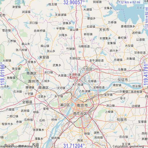
Xinji GPS coordinates[2]
32° 18' 29.7" North, 118° 42' 53.208" East
| Map corner | latitude | longitude |
|---|---|---|
| Upper-left | 32.90057°, | 118.01166° |
| Center: | 32.30825°, | 118.71478° |
| Lower-right: | 31.71204°, | 119.41791° |
| Map W x H: | 132.2×132.2 km | = 82.1×82.1mi |
| max Lat: | 53.31946° ⇑37% North |
| Xinji: | 32.30825° |
| min Lat: | ⇓63% South 18.22056° |
| min Long | Xinji | max Long |
| 75.07348° | 118.71478° | 134.28917° |
| W 74.5%⇐ | ⇒25.5% E |
Elevation
Elevation of Xinji is 15 m = 49 ft, and this is 469.8 m = 1541 ft below average elevation for this country.
| Max E: |
5622 m = 18445 ft | 85.5% |
| Avg. | 484.8 m = 1591 ft | |
| Xinji | 15 m = 49 ft | |
Min E: |
-3 m = -10 ft | 14.5% |
See also: China elevation on elevation.city.
Geographical zone
Xinji is located in North temperate zone (between Tropic of Cancer and the Arctic Circle). Distance of this Northern Tropic circle is 986.4 km =612.9 mi to South.| Distance of | km | miles | from Xinji |
|---|---|---|---|
| North Pole | 6414.7 | 3985.9 | to North |
| Arctic Circle | 3808.8 | 2366.7 | to North |
| Tropic Cancer | 986.4 | 612.9 | to South |
| Equator | 3592.3 | 2232.2 | to South |


Nearby cities:
15 places around Xinji: (largest is in red/bold)
• Chahe
16.6 km =10.3 mi,  226°
226°
• Changlu
8.5 km =5.3 mi,  126°
126°
• Chengqiao
8.7 km =5.4 mi,  5°
5°
• Daying
10.7 km =6.6 mi,  266°
266°
• Dushan
12.7 km =7.9 mi,  330°
330°
• Getang
7.4 km =4.6 mi,  163°
163°
• Guabu
17.2 km =10.7 mi,  112°
112°
• Leiguan
10.2 km =6.3 mi,  294°
294°
• Ma’an
15.2 km =9.4 mi,  43°
43°
• Pancheng
10.7 km =6.6 mi,  183°
183°
• Shanpan
9 km =5.6 mi, 157°
• Xichangmen
10.2 km =6.3 mi, 156°
• Xiejiadian
11.1 km =6.9 mi,  166°
166°
• Xiongzhou
13.3 km =8.3 mi,  72°
72°
• Yanjiang
16.1 km =10 mi, 181°
Sources, notices
• [Note1] Compared only with cities in China existing in our database
• [Src1] Map data: © OpenStreetMap contributors (CC-BY-SA)
• [Src2] Other city data from geonames.org with taken over terms of usage.
• [Src3] Geographical zone / Annual Mean Temperature by Robert A. Rohde @ Wikipedia
