Pancheng geodata
Pancheng (Jiangsu) is a seat of a fourth-order administrative division; located in China in Asia/Shanghai (GMT+8) time zone. In our database, there are 1268 cities with bigger population. Compared to other cities in China, 62.5% of cities are located further ↓South; 74.4% of cities are located further ←West and 83.9% of cities have higher elevation than Pancheng. Note1


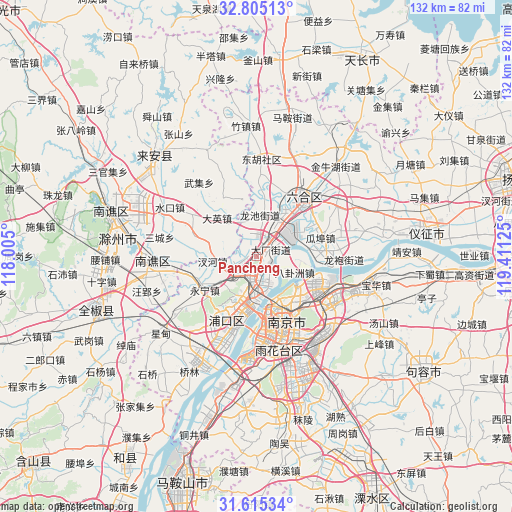
Pancheng GPS coordinates[2]
32° 12' 43.848" North, 118° 42' 29.232" East
| Map corner | latitude | longitude |
|---|---|---|
| Upper-left | 32.80513°, | 118.005° |
| Center: | 32.21218°, | 118.70812° |
| Lower-right: | 31.61534°, | 119.41125° |
| Map W x H: | 132.3×132.3 km | = 82.2×82.2mi |
| max Lat: | 53.31946° ⇑37.5% North |
| Pancheng: | 32.21218° |
| min Lat: | ⇓62.5% South 18.22056° |
| min Long | Pancheng | max Long |
| 75.07348° | 118.70812° | 134.28917° |
| W 74.4%⇐ | ⇒25.6% E |
Elevation
Elevation of Pancheng is 18 m = 59 ft, and this is 466.8 m = 1531 ft below average elevation for this country.
| Max E: |
5622 m = 18445 ft | 83.9% |
| Avg. | 484.8 m = 1591 ft | |
| Pancheng | 18 m = 59 ft | |
Min E: |
-3 m = -10 ft | 16.1% |
See also: China elevation on elevation.city.
Geographical zone
Pancheng is located in North temperate zone (between Tropic of Cancer and the Arctic Circle). Distance of this Northern Tropic circle is 975.7 km =606.3 mi to South.| Distance of | km | miles | from Pancheng |
|---|---|---|---|
| North Pole | 6425.4 | 3992.6 | to North |
| Arctic Circle | 3819.5 | 2373.3 | to North |
| Tropic Cancer | 975.7 | 606.3 | to South |
| Equator | 3581.7 | 2225.6 | to South |


Nearby cities:
15 places around Pancheng: (largest is in red/bold)
• Baguazhou
11.1 km =6.9 mi,  112°
112°
• Baotaqiao
11.7 km =7.3 mi,  158°
158°
• Chahe
11.4 km =7.1 mi,  266°
266°
• Changlu
9.3 km =5.8 mi,  53°
53°
• Daying
14.2 km =8.8 mi,  315°
315°
• Dingshan
11 km =6.8 mi,  193°
193°
• Getang
4.5 km =2.8 mi,  37°
37°
• Mufushan
12.5 km =7.8 mi,  150°
150°
• Shanpan
4.7 km =2.9 mi,  60°
60°
• Taishan
6.9 km =4.3 mi,  182°
182°
• Xichangmen
4.9 km =3 mi,  74°
74°
• Xiejiadian
3.2 km =2 mi,  92°
92°
• Xinji
10.7 km =6.6 mi,  3°
3°
• Yanjiang
5.4 km =3.4 mi, 176°
• Yanziji
12.9 km =8 mi,  125°
125°
Sources, notices
• [Note1] Compared only with cities in China existing in our database
• [Src1] Map data: © OpenStreetMap contributors (CC-BY-SA)
• [Src2] Other city data from geonames.org with taken over terms of usage.
• [Src3] Geographical zone / Annual Mean Temperature by Robert A. Rohde @ Wikipedia
