Xunchang geodata
Xunchang (Sichuan) is a seat of a third-order administrative division; located in China in Asia/Shanghai (GMT+8) time zone. With population of 64,580 people, there are 673 cities with bigger population in this country. Compared to other cities in China, 70.1% of cities are located further ↑North; 89.4% of cities are located further →East and 74.7% of cities have lower elevation than Xunchang. Note1


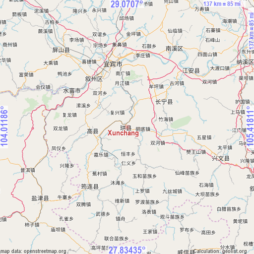
Xunchang GPS coordinates[2]
28° 27' 15.588" North, 104° 42' 53.928" East
| Map corner | latitude | longitude |
|---|---|---|
| Upper-left | 29.0707°, | 104.01186° |
| Center: | 28.45433°, | 104.71498° |
| Lower-right: | 27.83435°, | 105.41811° |
| Map W x H: | 137.5×137.5 km | = 85.4×85.4mi |
| max Lat: | 53.31946° ⇑70.1% North |
| Xunchang: | 28.45433° |
| min Lat: | ⇓29.9% South 18.22056° |
| min Long | Xunchang | max Long |
| 75.07348° | 104.71498° | 134.28917° |
| W 10.6%⇐ | ⇒89.4% E |
Elevation
Elevation of Xunchang is 515 m = 1690 ft, and this is 30.2 m = 99 ft above average elevation for this country.
| Max E: |
5622 m = 18445 ft | 25.3% |
| Xunchang | 515 m 1690 ft | |
| Avg. | 484.8 m = 1591 ft | |
Min E: |
-3 m = -10 ft | 74.7% |
See also: Xunchang elevation on elevation.city.
Geographical zone
Xunchang is located in North temperate zone (between Tropic of Cancer and the Arctic Circle). Distance of this Northern Tropic circle is 557.9 km =346.7 mi to South.| Distance of | km | miles | from Xunchang |
|---|---|---|---|
| North Pole | 6843.2 | 4252.2 | to North |
| Arctic Circle | 4237.3 | 2632.9 | to North |
| Tropic Cancer | 557.9 | 346.7 | to South |
| Equator | 3163.8 | 1965.9 | to South |


Nearby cities:
15 places around Xunchang: (largest is in red/bold)
• Baixi
31.7 km =19.7 mi,  329°
329°
• Changning
24.3 km =15.1 mi,  55°
55°
• Huiyi
51.9 km =32.2 mi,  290°
290°
• Jiang’an
46.4 km =28.8 mi,  48°
48°
• Junlian
37.3 km =23.2 mi,  212°
212°
• Nanxi
50.3 km =31.3 mi,  30°
30°
• Niupizhai
50.2 km =31.2 mi,  220°
220°
• Qingfu
19.5 km =12.1 mi,  264°
264°
• Taipingdian
49.6 km =30.8 mi,  283°
283°
• Tantou
47.8 km =29.7 mi,  246°
246°
• Tantouchang
45.1 km =28 mi, 249°
• Xiangjiaba
36.3 km =22.6 mi,  303°
303°
• Xinglongchang
38.1 km =23.7 mi,  236°
236°
• Yibin
35.9 km =22.3 mi,  345°
345°
• Zhongcheng
53 km =32.9 mi,  107°
107°
Sources, notices
• [Note1] Compared only with cities in China existing in our database
• [Src1] Map data: © OpenStreetMap contributors (CC-BY-SA)
• [Src2] Other city data from geonames.org with taken over terms of usage.
• [Src3] Geographical zone / Annual Mean Temperature by Robert A. Rohde @ Wikipedia
