Xiejiatan geodata
Xiejiatan (Jiangxi) is a seat of a fourth-order administrative division; located in China in Asia/Shanghai (GMT+8) time zone. In our database, there are 1268 cities with bigger population. Compared to other cities in China, 59.9% of cities are located further ↑North; 64.4% of cities are located further ←West and 80.8% of cities have higher elevation than Xiejiatan. Note1


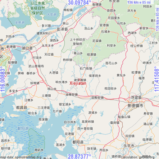
Xiejiatan GPS coordinates[2]
29° 29' 15.54" North, 116° 42' 43.02" East
| Map corner | latitude | longitude |
|---|---|---|
| Upper-left | 30.09784°, | 116.00883° |
| Center: | 29.48765°, | 116.71195° |
| Lower-right: | 28.87377°, | 117.41508° |
| Map W x H: | 136.1×136.1 km | = 84.6×84.6mi |
| max Lat: | 53.31946° ⇑59.9% North |
| Xiejiatan: | 29.48765° |
| min Lat: | ⇓40.1% South 18.22056° |
| min Long | Xiejiatan | max Long |
| 75.07348° | 116.71195° | 134.28917° |
| W 64.4%⇐ | ⇒35.6% E |
Elevation
Elevation of Xiejiatan is 25 m = 82 ft, and this is 459.8 m = 1509 ft below average elevation for this country.
| Max E: |
5622 m = 18445 ft | 80.8% |
| Avg. | 484.8 m = 1591 ft | |
| Xiejiatan | 25 m = 82 ft | |
Min E: |
-3 m = -10 ft | 19.2% |
See also: China elevation on elevation.city.
Geographical zone
Xiejiatan is located in North temperate zone (between Tropic of Cancer and the Arctic Circle). Distance of this Northern Tropic circle is 672.8 km =418.1 mi to South.| Distance of | km | miles | from Xiejiatan |
|---|---|---|---|
| North Pole | 6728.3 | 4180.8 | to North |
| Arctic Circle | 4122.5 | 2561.6 | to North |
| Tropic Cancer | 672.8 | 418.1 | to South |
| Equator | 3278.7 | 2037.3 | to South |


Nearby cities:
15 places around Xiejiatan: (largest is in red/bold)
• Dagang
23.2 km =14.4 mi,  286°
286°
• Houjiagang
13.7 km =8.5 mi,  73°
73°
• Longquan
19.6 km =12.2 mi,  30°
30°
• Mingshan
25.2 km =15.7 mi,  252°
252°
• Qingshan
23 km =14.3 mi,  356°
356°
• Shimenjie
11.3 km =7 mi, 28°
• Shishan
26.3 km =16.3 mi,  237°
237°
• Tielu
13.4 km =8.3 mi, 358°
• Xiangshuitang
15.7 km =9.8 mi,  264°
264°
• Yangzi
20 km =12.4 mi,  328°
328°
• Yaquehu
19.9 km =12.4 mi,  203°
203°
• Yinbaohu
25.4 km =15.8 mi,  210°
210°
• Youdunjie
14.3 km =8.9 mi, 210°
• Zhegang
15.9 km =9.9 mi,  173°
173°
• Zhongguan
20.9 km =13 mi, 236°
Sources, notices
• [Note1] Compared only with cities in China existing in our database
• [Src1] Map data: © OpenStreetMap contributors (CC-BY-SA)
• [Src2] Other city data from geonames.org with taken over terms of usage.
• [Src3] Geographical zone / Annual Mean Temperature by Robert A. Rohde @ Wikipedia
