Yangzi geodata
Yangzi (Jiangxi) is a seat of a fourth-order administrative division; located in China in Asia/Shanghai (GMT+8) time zone. In our database, there are 1268 cities with bigger population. Compared to other cities in China, 58.1% of cities are located further ↑North; 63.7% of cities are located further ←West and 69.7% of cities have higher elevation than Yangzi. Note1


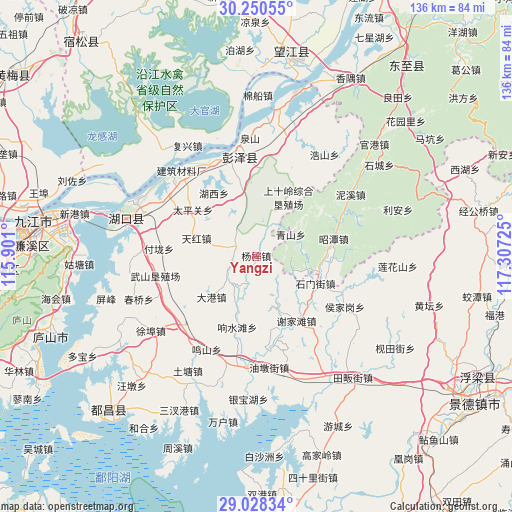
Yangzi GPS coordinates[2]
29° 38' 28.68" North, 116° 36' 14.832" East
| Map corner | latitude | longitude |
|---|---|---|
| Upper-left | 30.25055°, | 115.901° |
| Center: | 29.6413°, | 116.60412° |
| Lower-right: | 29.02834°, | 117.30725° |
| Map W x H: | 135.9×135.9 km | = 84.4×84.4mi |
| max Lat: | 53.31946° ⇑58.1% North |
| Yangzi: | 29.6413° |
| min Lat: | ⇓41.9% South 18.22056° |
| min Long | Yangzi | max Long |
| 75.07348° | 116.60412° | 134.28917° |
| W 63.7%⇐ | ⇒36.3% E |
Elevation
Elevation of Yangzi is 53 m = 174 ft, and this is 431.8 m = 1417 ft below average elevation for this country.
| Max E: |
5622 m = 18445 ft | 69.7% |
| Avg. | 484.8 m = 1591 ft | |
| Yangzi | 53 m = 174 ft | |
Min E: |
-3 m = -10 ft | 30.3% |
See also: China elevation on elevation.city.
Geographical zone
Yangzi is located in North temperate zone (between Tropic of Cancer and the Arctic Circle). Distance of this Northern Tropic circle is 689.9 km =428.7 mi to South.| Distance of | km | miles | from Yangzi |
|---|---|---|---|
| North Pole | 6711.3 | 4170.2 | to North |
| Arctic Circle | 4105.4 | 2551 | to North |
| Tropic Cancer | 689.9 | 428.7 | to South |
| Equator | 3295.8 | 2047.9 | to South |


Nearby cities:
15 places around Yangzi: (largest is in red/bold)
• Dagang
15.8 km =9.8 mi,  228°
228°
• Dalong
24.1 km =15 mi,  298°
298°
• Dongsheng
22.8 km =14.2 mi,  22°
22°
• Fulong
25.8 km =16 mi,  274°
274°
• Furongdun
26.5 km =16.5 mi,  336°
336°
• Huanghua
24.6 km =15.3 mi,  357°
357°
• Huangling
18 km =11.2 mi,  347°
347°
• Longquan
20.2 km =12.6 mi,  90°
90°
• Qingshan
10.8 km =6.7 mi,  57°
57°
• Shimenjie
17.3 km =10.7 mi,  114°
114°
• Taipingguan
20.9 km =13 mi,  306°
306°
• Tianhong
16.7 km =10.4 mi,  286°
286°
• Tielu
10.8 km =6.7 mi, 109°
• Xiangshuitang
19.2 km =11.9 mi,  195°
195°
• Xiejiatan
20 km =12.4 mi,  148°
148°
Sources, notices
• [Note1] Compared only with cities in China existing in our database
• [Src1] Map data: © OpenStreetMap contributors (CC-BY-SA)
• [Src2] Other city data from geonames.org with taken over terms of usage.
• [Src3] Geographical zone / Annual Mean Temperature by Robert A. Rohde @ Wikipedia
