Xiejiapu geodata
Xiejiapu (Hunan) is a seat of a fourth-order administrative division; located in China in Asia/Shanghai (GMT+8) time zone. In our database, there are 1268 cities with bigger population. Compared to other cities in China, 66.9% of cities are located further ↑North; 63.5% of cities are located further →East and 68.2% of cities have higher elevation than Xiejiapu. Note1


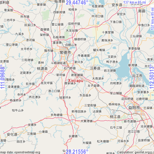
Xiejiapu GPS coordinates[2]
28° 49' 59.988" North, 111° 48' 0" East
| Map corner | latitude | longitude |
|---|---|---|
| Upper-left | 29.44746°, | 111.09688° |
| Center: | 28.83333°, | 111.8° |
| Lower-right: | 28.21556°, | 112.50313° |
| Map W x H: | 137×137 km | = 85.1×85.1mi |
| max Lat: | 53.31946° ⇑66.9% North |
| Xiejiapu: | 28.83333° |
| min Lat: | ⇓33.1% South 18.22056° |
| min Long | Xiejiapu | max Long |
| 75.07348° | 111.8° | 134.28917° |
| W 36.5%⇐ | ⇒63.5% E |
Elevation
Elevation of Xiejiapu is 59 m = 194 ft, and this is 425.8 m = 1397 ft below average elevation for this country.
| Max E: |
5622 m = 18445 ft | 68.2% |
| Avg. | 484.8 m = 1591 ft | |
| Xiejiapu | 59 m = 194 ft | |
Min E: |
-3 m = -10 ft | 31.8% |
See also: China elevation on elevation.city.
Geographical zone
Xiejiapu is located in North temperate zone (between Tropic of Cancer and the Arctic Circle). Distance of this Northern Tropic circle is 600 km =372.8 mi to South.| Distance of | km | miles | from Xiejiapu |
|---|---|---|---|
| North Pole | 6801.1 | 4226 | to North |
| Arctic Circle | 4195.2 | 2606.8 | to North |
| Tropic Cancer | 600 | 372.8 | to South |
| Equator | 3206 | 1992.1 | to South |


Nearby cities:
15 places around Xiejiapu: (largest is in red/bold)
• Canggang
12 km =7.5 mi,  44°
44°
• Changmaoling
19.9 km =12.4 mi,  254°
254°
• Deshan
13.6 km =8.5 mi,  321°
321°
• Dongjiao
22.6 km =14 mi,  337°
337°
• Doumuhu
21.1 km =13.1 mi,  307°
307°
• Hanshou
17.2 km =10.7 mi,  62°
62°
• Huangtudian
16.1 km =10 mi,  225°
225°
• Ludishan
20.1 km =12.5 mi, 341°
• Niubitan
20.4 km =12.7 mi,  16°
16°
• Qianjiaping
21.3 km =13.2 mi,  205°
205°
• Shimenqiao
10.1 km =6.3 mi, 322°
• Weidihu
22.4 km =13.9 mi, 44°
• Xinxing
14 km =8.7 mi,  9°
9°
• Zhujiapu
8.3 km =5.2 mi,  185°
185°
• Zhumushan
16.3 km =10.1 mi,  92°
92°
Sources, notices
• [Note1] Compared only with cities in China existing in our database
• [Src1] Map data: © OpenStreetMap contributors (CC-BY-SA)
• [Src2] Other city data from geonames.org with taken over terms of usage.
• [Src3] Geographical zone / Annual Mean Temperature by Robert A. Rohde @ Wikipedia
