Canggang geodata
Canggang (Hunan) is a seat of a fourth-order administrative division; located in China in Asia/Shanghai (GMT+8) time zone. In our database, there are 1268 cities with bigger population. Compared to other cities in China, 66.3% of cities are located further ↑North; 63.2% of cities are located further →East and 76.7% of cities have higher elevation than Canggang. Note1


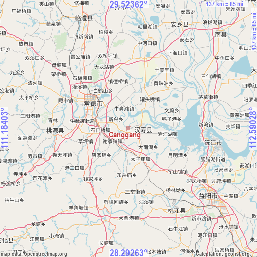
Canggang GPS coordinates[2]
28° 54' 35.82" North, 111° 53' 13.74" East
| Map corner | latitude | longitude |
|---|---|---|
| Upper-left | 29.52362°, | 111.18403° |
| Center: | 28.90995°, | 111.88715° |
| Lower-right: | 28.29263°, | 112.59028° |
| Map W x H: | 136.9×136.9 km | = 85.1×85.1mi |
| max Lat: | 53.31946° ⇑66.3% North |
| Canggang: | 28.90995° |
| min Lat: | ⇓33.7% South 18.22056° |
| min Long | Canggang | max Long |
| 75.07348° | 111.88715° | 134.28917° |
| W 36.8%⇐ | ⇒63.2% E |
Elevation
Elevation of Canggang is 33 m = 108 ft, and this is 451.8 m = 1482 ft below average elevation for this country.
| Max E: |
5622 m = 18445 ft | 76.7% |
| Avg. | 484.8 m = 1591 ft | |
| Canggang | 33 m = 108 ft | |
Min E: |
-3 m = -10 ft | 23.3% |
See also: China elevation on elevation.city.
Geographical zone
Canggang is located in North temperate zone (between Tropic of Cancer and the Arctic Circle). Distance of this Northern Tropic circle is 608.6 km =378.2 mi to South.| Distance of | km | miles | from Canggang |
|---|---|---|---|
| North Pole | 6792.6 | 4220.7 | to North |
| Arctic Circle | 4186.7 | 2601.5 | to North |
| Tropic Cancer | 608.6 | 378.2 | to South |
| Equator | 3214.5 | 1997.4 | to South |


Nearby cities:
15 places around Canggang: (largest is in red/bold)
• Deshan
17.1 km =10.6 mi,  276°
276°
• Dongjiang
19.4 km =12.1 mi,  315°
315°
• Guantouzui
19.4 km =12.1 mi,  35°
35°
• Hangongdu
20.1 km =12.5 mi,  8°
8°
• Hanshou
6.7 km =4.2 mi,  93°
93°
• Ludishan
18.1 km =11.2 mi,  305°
305°
• Niubitan
11.3 km =7 mi,  346°
346°
• Shimenqiao
14.7 km =9.1 mi,  267°
267°
• Weidihu
10.4 km =6.5 mi, 44°
• Xiejiapu
12 km =7.5 mi,  224°
224°
• Xinxing
8.1 km =5 mi, 310°
• Zhoukou
19.3 km =12 mi,  52°
52°
• Zhouwenmiao
16 km =9.9 mi, 89°
• Zhujiapu
19.2 km =11.9 mi,  209°
209°
• Zhumushan
12.1 km =7.5 mi,  139°
139°
Sources, notices
• [Note1] Compared only with cities in China existing in our database
• [Src1] Map data: © OpenStreetMap contributors (CC-BY-SA)
• [Src2] Other city data from geonames.org with taken over terms of usage.
• [Src3] Geographical zone / Annual Mean Temperature by Robert A. Rohde @ Wikipedia
